Clay City, Indiana facts for kids
Quick facts for kids
Clay City, Indiana
|
|
|---|---|
 |
|

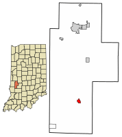
Location of Clay City in Clay County, Indiana.
|
|
| Country | United States |
| State | Indiana |
| County | Clay |
| Township | Harrison |
| Area | |
| • Total | 0.54 sq mi (1.40 km2) |
| • Land | 0.54 sq mi (1.40 km2) |
| • Water | 0.00 sq mi (0.00 km2) |
| Elevation | 594 ft (181 m) |
| Population
(2020)
|
|
| • Total | 878 |
| • Density | 1,628.94/sq mi (629.03/km2) |
| Time zone | UTC-5 (EST) |
| • Summer (DST) | UTC-5 (EST) |
| ZIP code |
47841
|
| Area code(s) | 812 |
| FIPS code | 18-13276 |
| GNIS feature ID | 0432585 |
| Website | http://www.claycity.net/ |
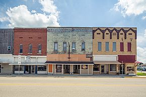
Clay City is a small town located in Clay County, Indiana, in the United States. It is part of Harrison Township. In 2020, about 878 people lived there. Clay City is also part of the larger Terre Haute metropolitan area.
Contents
History of Clay City's Name
Clay City was first planned in 1873. At that time, a railroad was built to reach this area. The town was first called "Markland." However, this name could not be used because another post office in Indiana already had it.
So, the town was renamed "Huntersville." This new name honored Morton C. Hunter, who was a U.S. Congressman. But the people living in the area did not like him very much. They did not want their town named after him.
Because of this, a local group chose a new name: "Clay City." This name was chosen to honor Henry Clay. He was a famous American statesman from Kentucky.
Where is Clay City Located?
Clay City is found at coordinates 39.277048 degrees North and -87.112079 degrees West.
According to information from 2010, the town covers a total area of about 0.54 square miles (1.4 square kilometers). All of this area is land.
How Many People Live in Clay City?
| Historical population | |||
|---|---|---|---|
| Census | Pop. | %± | |
| 1880 | 419 | — | |
| 1890 | 1,004 | 139.6% | |
| 1900 | 1,503 | 49.7% | |
| 1910 | 1,213 | −19.3% | |
| 1920 | 1,226 | 1.1% | |
| 1930 | 1,079 | −12.0% | |
| 1940 | 1,117 | 3.5% | |
| 1950 | 1,068 | −4.4% | |
| 1960 | 950 | −11.0% | |
| 1970 | 900 | −5.3% | |
| 1980 | 883 | −1.9% | |
| 1990 | 929 | 5.2% | |
| 2000 | 1,019 | 9.7% | |
| 2010 | 861 | −15.5% | |
| 2020 | 878 | 2.0% | |
| U.S. Decennial Census | |||
Population in 2010
In 2010, there were 861 people living in Clay City. These people lived in 361 households. About 241 of these households were families.
Most of the people in Clay City were White (99.2%). A small number were Asian (0.1%), or from two or more races (0.7%). About 0.7% of the population was Hispanic or Latino.
About 31% of the households had children under 18 living there. More than half (51%) were married couples living together. About 16.7% of households had someone living alone who was 65 years old or older.
The average age of people in the town was 39.2 years. About 24.5% of residents were under 18. About 19.6% were 65 years or older. More females lived in the town (55.4%) than males (44.6%).
See also

- In Spanish: Clay City (Indiana) para niños
 | William L. Dawson |
 | W. E. B. Du Bois |
 | Harry Belafonte |

