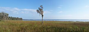
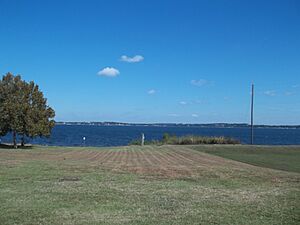
Clermont chain of lakes facts for kids
The Clermont chain of lakes is a group of lakes found near Clermont, Florida. These lakes stretch from the southeast to the northwest. They get their water mainly from streams and groundwater. They are an important part of the Palatlakaha River system, which eventually flows into the Ocklawaha River. You might notice that the water in these lakes can look red or tea-colored. This is because of something called tannic acid, which comes from plants.
Contents
Discover the Clermont Chain of Lakes
The chain includes many lakes, but three are the largest and form the main part of the system. These are Lake Louisa, Lake Minnehaha, and Lake Minneola.
Lake Louisa: The Largest Lake
Quick facts for kids Lake Louisa |
|
|---|---|
| Location | Lake County, Florida |
| Coordinates | 28°28′52″N 81°44′23″W / 28.4810°N 81.7398°W |
| Lake type | natural freshwater lake |
| Basin countries | United States |
| Max. length | 3.29 miles (5.29 km) |
| Max. width | 2.24 miles (3.60 km) |
| Surface area | 3,573 acres (1,446 ha) |
| Max. depth | 16 feet (4.9 m) |
| Surface elevation | 85 feet (26 m) |
Lake Louisa is the biggest lake in the chain. It is quite shallow, usually around 10 feet deep, and has a flat bottom. A big part of its southern shore is home to Lake Louisa State Park. This park is a great place to explore nature. Other parts of the lake's shore have houses and neighborhoods.
Two main streams, Little Creek and Big Creek, flow into Lake Louisa. Little Creek starts near the border of Lake and Polk Counties. Big Creek begins in the Green Swamp area. From the northern end of Lake Louisa, Crooked Creek flows into Lake Susan. Lake Susan is a smaller lake surrounded by swampy land. You can find a public boat ramp on Crooked Creek.
Lake Minnehaha: Second Largest
| Lake Minnehaha | |
|---|---|
| Location | Lake County, Florida |
| Coordinates | 28°32′00″N 81°45′56″W / 28.5332°N 81.7656°W |
| Lake type | natural freshwater lake |
| Basin countries | United States |
| Max. length | 2.56 miles (4.12 km) |
| Max. width | 1.75 miles (2.82 km) |
| Surface area | 2,410.76 acres (976 ha) |
| Max. depth | 18 feet (5.5 m) |
| Surface elevation | 95 feet (29 m) |
A short river connects Lake Susan to Lake Minnehaha, which is the second largest lake. Lake Minnehaha is usually about 14 feet deep, with some spots going over 18 feet. More houses and neighborhoods are built around Lake Minnehaha compared to Lake Louisa. However, a bay on its northwest side, called Cypress Cove, is still swampland.
From Lake Minnehaha, a narrow waterway leads to Lake Palatlakaha. This lake is mostly undeveloped, except for a community on its eastern side. A canal then connects Lake Palatlakaha to Lake Hiawatha. Lake Hiawatha is also mostly undeveloped. The community of Hiawatha Shores is on its south shore.
Lake Minneola: Deepest and Most Developed
| Lake Minneola | |
|---|---|
| Location | Lake County, Florida |
| Coordinates | 28°34′31″N 81°46′06″W / 28.5753°N 81.7684°W |
| Lake type | natural freshwater lake |
| Basin countries | United States |
| Max. length | 2.24 miles (3.60 km) |
| Max. width | 2.19 miles (3.52 km) |
| Surface area | 1,890 acres (765 ha) |
| Surface elevation | 81 ft (25 m) |
A narrow strip of land separates Lake Hiawatha from Lake Minneola. This is the third largest lake in the chain. It is also the deepest, reaching about 18 feet in most places. Near downtown Clermont, it can be almost 30 feet deep! Lake Minneola has the most development around it. Downtown Clermont and Minneola are located along its south and eastern shores.
The Palatlakaha River flows out of Crystal Cove on Lake Minneola's northwest shore. There is a public boat ramp and a swimming area at Waterfront Park, which is a popular spot.
Exploring Smaller Lakes
Many smaller lakes are also connected to the main chain.
Dixie Lake is the largest lake inside Lake Louisa State Park. When water levels are high, it flows into Big Creek. You can find rental cabins on its southern shore.
Crescent Lake is in the area of South Clermont. It is connected to Lake Minnehaha through Lake Hattie and Lake Williamee by a canal. Crescent Lake has a bay at its south end, called Crescent Cove. Lake Hattie is round and has three boat ramps for private communities. Lake Williamee is mostly shallow and covered with plants.
Lake Winona is in Clermont. It sits on a piece of land between Lake Minneola and Lake Minnehaha. A canal connects it to Lake Minnehaha. Lake Winona has similar depths to Lake Minnehaha, with some deeper areas like Lake Minneola.
The Northern Lakes of the Chain
North of the main chain, the Palatlakaha River flows through eight more lakes. The area around these lakes is part of the city of Groveland.
Hunt and Cook lakes are undeveloped and surrounded by swampland. Cherry Lake is the fourth largest lake in the entire chain. It has some rural homes on its north shore. It averages 10 feet deep but can reach 18 feet. Hunt and Stewart lakes are similar to Cherry Lake. They have rural homes on their north side and swampland on their south side. There is a dam between Hunt and Cherry Lakes to control water levels.
Lakes Lucy and Emma are surrounded by rural homes and sandy hills. Lake Lucy is about 10 feet deep, while Lake Emma is deeper at 14 feet. Heart Lake is separated from the Palatlakaha River by a dike, which also has a water level control dam. After Heart Lake, the Palatlakaha River continues its journey to Lake Harris.
 | Kyle Baker |
 | Joseph Yoakum |
 | Laura Wheeler Waring |
 | Henry Ossawa Tanner |


