Groveland, Florida facts for kids
Quick facts for kids
Groveland, Florida
|
|
|---|---|

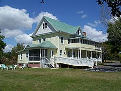
Historic Edge House
|
|

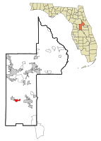
Location in Lake County and the state of Florida
|
|
| Country | |
| State | |
| County | |
| Area | |
| • Total | 27.46 sq mi (71.12 km2) |
| • Land | 20.84 sq mi (53.98 km2) |
| • Water | 6.62 sq mi (17.13 km2) |
| Elevation | 121 ft (37 m) |
| Population
(2020)
|
|
| • Total | 18,505 |
| • Estimate
(2021)
|
20,398 |
| • Density | 887.83/sq mi (342.79/km2) |
| Time zone | UTC-5 (Eastern (EST)) |
| • Summer (DST) | UTC-4 (EDT) |
| ZIP code |
34736
|
| Area code(s) | 352 |
| FIPS code | 12-27800 |
| GNIS feature ID | 2403764 |
| Website | http://groveland-fl.gov/ |
Groveland is a city in Lake County, Florida, United States. In 2020, about 18,505 people lived there. The city is located where State Road 19 and State Road 33/50 meet.
Groveland is part of the larger Orlando–Kissimmee–Sanford Metropolitan Statistical Area. It is also known as the first International Dark Sky Community in Florida. This means it has special rules to protect the night sky from too much light.
Contents
Geography of Groveland
Groveland is located at 28°33′28″N 81°51′7″W / 28.55778°N 81.85194°W. The city covers a total area of about 3 square miles (7.8 square kilometers). Most of this area is land, while a smaller part is water.
Population in Groveland
| Historical population | |||
|---|---|---|---|
| Census | Pop. | %± | |
| 1930 | 470 | — | |
| 1940 | 411 | −12.6% | |
| 1950 | 1,028 | 150.1% | |
| 1960 | 1,747 | 69.9% | |
| 1970 | 1,928 | 10.4% | |
| 1980 | 1,992 | 3.3% | |
| 1990 | 2,300 | 15.5% | |
| 2000 | 2,360 | 2.6% | |
| 2010 | 8,729 | 269.9% | |
| 2020 | 18,505 | 112.0% | |
| 2022 (est.) | 22,374 | 156.3% | |
| U.S. Decennial Census | |||
Groveland has grown a lot over the years. In 2010, there were 8,729 people living in the city. By 2020, the population had more than doubled to 18,505 people. This growth shows that more and more families are choosing to live in Groveland.
History of Groveland
The Groveland Case
The Groveland case was a very important event in the history of civil rights in Florida. It involved four young African American men in 1949. They were accused of a crime and faced an unfair trial.
The jury that decided their case was made up only of white people. Even though there was evidence against them, the way the trial was handled was not fair. News reports at the time made it seem like the young men were already guilty.
Thurgood Marshall, who later became a Supreme Court Justice, helped with their case. He worked with the NAACP's Legal Defense Fund. The case went all the way to the U.S. Supreme Court. The Supreme Court decided that the trial was unfair because of the strong negative news coverage. They ordered a new trial.
During this time, Harry T. Moore, who led the Florida NAACP, worked to support the men. Sadly, two of the men were shot by the sheriff while they were in custody. One of them died. Later, in 1951, a bomb exploded at Harry T. Moore's home, killing him and his wife, Harriette. No one was ever brought to trial for this terrible act.
Years later, in 2016, the City of Groveland and Lake County apologized for the injustice. In 2019, the Florida Board of Executive Clemency officially pardoned the four men. This means their names were cleared. In 2021, a judge officially declared them innocent after their deaths.
Cemetery Restoration Grant
In 2022, the city received money to help restore The Oak Tree Union Colored Cemetery of Taylorville. This is an old, abandoned cemetery in Groveland. The grant will help bring the cemetery back to good condition.
Arts and Culture in Groveland
Becoming an International Dark Sky Community
In 2022, Groveland started a new rule about outdoor lighting. This rule helps to reduce light pollution, which is when too much artificial light brightens the night sky. The goal is to protect the natural darkness of the night.
Groveland is changing its old streetlights to new ones that point light downwards and have a softer glow. They plan to finish this by 2027.
In 2023, Groveland became the first official International Dark Sky Community in Florida. This was a big achievement that took three years of work. It involved teaching people about light pollution, holding events, and changing city rules. Groveland even had its first Star Party in 2023, where over 700 people came to look at the stars.
The city continues to teach new residents and developers about the importance of dark skies. This helps keep the environment healthy and improves safety and quality of life for everyone.
Transportation in Groveland
Osborn Airfield is a small airport located about three miles southwest of Groveland. It is a private airport, but it is open for small planes and general flying activities.
Notable People from Groveland
- Jeff Demps - A former Running back and Olympic Silver Medalist in the London 2012 games.
- Jonotthan Harrison - An NFL (National Football League) player.
- Art Heyman - A well-known college basketball player.
- Jett Noland - A professional racing driver.
See also
 In Spanish: Groveland (Florida) para niños
 | Sharif Bey |
 | Hale Woodruff |
 | Richmond Barthé |
 | Purvis Young |

