Cloverdale, Ohio facts for kids
Quick facts for kids
Cloverdale, Ohio
|
|
|---|---|
|
Village
|
|

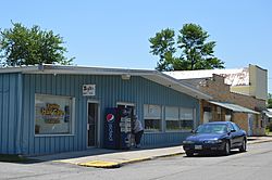
Commercial buildings on Mahoning Street
|
|

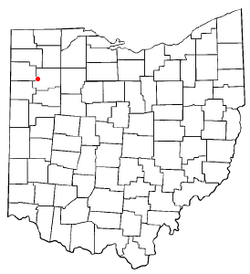
Location of Cloverdale, Ohio
|
|

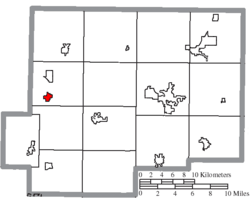
Location of Cloverdale in Putnam County
|
|
| Country | United States |
| State | Ohio |
| County | Putnam |
| Area | |
| • Total | 0.62 sq mi (1.61 km2) |
| • Land | 0.62 sq mi (1.60 km2) |
| • Water | 0.01 sq mi (0.02 km2) |
| Elevation | 722 ft (220 m) |
| Population
(2020)
|
|
| • Total | 170 |
| • Estimate
(2023)
|
167 |
| • Density | 275.97/sq mi (106.54/km2) |
| Time zone | UTC-5 (Eastern (EST)) |
| • Summer (DST) | UTC-4 (EDT) |
| ZIP code |
45827
|
| Area code(s) | 419 |
| FIPS code | 39-16266 |
| GNIS feature ID | 2398584 |
Cloverdale is a small village located in Perry Township, Putnam County, Ohio, United States. In 2020, about 170 people lived there.
Contents
Discovering Cloverdale's Past
Cloverdale was first known as Evansville. It was officially mapped out in 1877. This happened when the railroad lines were built to reach the area.
The village's current name, Cloverdale, likely came from the Clover Leaf Railroad. This train line passed through a nearby railway junction. Cloverdale officially became a village in 1902.
When a Tornado Hit Cloverdale
On November 17, 2013, a strong tornado touched down near Cloverdale. It was an EF-2 tornado, which means it was quite powerful. The tornado caused some damage to buildings and homes. Many trees and power lines were also knocked down. A church in the village had significant damage to its walls and roof. A house nearby also had one of its walls collapse.
Where is Cloverdale Located?
Cloverdale is a small village. It covers a total area of about 0.62 square miles (1.61 square kilometers). Most of this area is land, with a very small part being water.
Who Lives in Cloverdale?
| Historical population | |||
|---|---|---|---|
| Census | Pop. | %± | |
| 1910 | 222 | — | |
| 1920 | 180 | −18.9% | |
| 1930 | 227 | 26.1% | |
| 1940 | 185 | −18.5% | |
| 1950 | 200 | 8.1% | |
| 1960 | 237 | 18.5% | |
| 1970 | 253 | 6.8% | |
| 1980 | 304 | 20.2% | |
| 1990 | 270 | −11.2% | |
| 2000 | 201 | −25.6% | |
| 2010 | 168 | −16.4% | |
| 2020 | 170 | 1.2% | |
| 2023 (est.) | 167 | −0.6% | |
| U.S. Decennial Census | |||
Cloverdale's Population in 2010
In 2010, there were 168 people living in Cloverdale. These people lived in 69 different homes. About 43 of these homes were families.
Most of the people living in the village were White. A small number of people were African American or from other backgrounds. About 3% of the population identified as Hispanic or Latino.
In 2010, about one-third of the homes had children under 18 living there. Many homes were married couples living together. Some homes had a single parent, either a mother or a father. About 38% of all homes were individuals living alone. A small number of these individuals were 65 years old or older.
The average age of people in Cloverdale was about 35 years old. About 30% of residents were under 18. About 8% were between 18 and 24 years old. People aged 25 to 44 made up about 24% of the population. Those aged 45 to 64 were about 30%. Finally, about 8% of residents were 65 years old or older. The village had a nearly equal number of males and females.
See also
 In Spanish: Cloverdale (Ohio) para niños
 | Selma Burke |
 | Pauline Powell Burns |
 | Frederick J. Brown |
 | Robert Blackburn |

