Coaldale, Colorado facts for kids
Quick facts for kids
Coaldale, Colorado
|
|
|---|---|

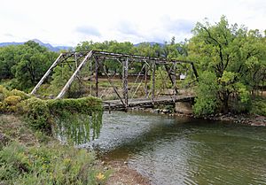
An abandoned bridge over the Arkansas River in Coaldale
|
|

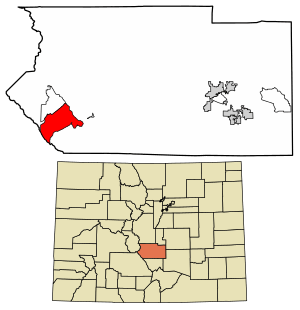
Location of the Coaldale CDP in Fremont County, Colorado.
|
|
| Country | |
| State | |
| County | Fremont County |
| Founded | 1891 |
| Government | |
| • Type | unincorporated community |
| Area | |
| • Total | 31.048 sq mi (80.413 km2) |
| • Land | 31.048 sq mi (80.413 km2) |
| • Water | 0 sq mi (0.000 km2) |
| Elevation | 6,550 ft (2,658 m) |
| Population
(2020)
|
|
| • Total | 343 |
| • Density | 11.048/sq mi (4.265/km2) |
| Time zone | UTC-7 (MST) |
| • Summer (DST) | UTC-6 (MDT) |
| ZIP Code |
81222
|
| Area code(s) | 719 |
| GNIS feature | Coaldale CDP |
Coaldale is a small community in Fremont County, Colorado, in the United States. It's known as a census-designated place (CDP). This means it's an area that the government counts for population numbers. Coaldale does not have its own local government like a city or town. It also has its own post office with the ZIP Code 81222. In 2020, about 343 people lived there.
Contents
Coaldale's History
Coaldale was founded in 1891. It is part of the larger Fremont County area. You can learn more about the early days of the county in the article about the Early history of Fremont County, Colorado.
Exploring Coaldale's Geography
Coaldale is located in the southwestern part of Fremont County.
Where is Coaldale Located?
To its northwest, Coaldale borders the community of Howard. The Arkansas River flows along the northeastern edge of Coaldale. U.S. Route 50 also follows the river as it passes through the community.
Nearby Towns and Natural Features
Cañon City, which is the main town of the county, is about 37 miles (60 km) to the east. This is downstream along the Arkansas River. Salida is about 21 miles (34 km) to the northwest, which is upstream.
Coaldale covers an area of about 80.413 square kilometers (31.048 square miles). All of this area is land. The community stretches southwest from the Arkansas River valley. It goes up into the San Isabel National Forest and the Sangre de Cristo Range mountains.
Coaldale's Borders
The southeastern edge of Coaldale follows the Hayden Creek valley up to Hayden Pass. The southwestern edge follows the border with Saguache County along the top of the Sangre de Cristos mountains. The northwestern edge follows Stout Creek and Kerr Gulch Road back down to the Arkansas River valley.
Population and Demographics
The United States Census Bureau first officially counted Coaldale as a census-designated place for the United States Census 2010.
How Many People Live in Coaldale?
The population of Coaldale has changed over the years:
- In 2010, the population was 255 people.
- In 2020, the population grew to 343 people.
See also
 In Spanish: Coaldale (Colorado) para niños


