Howard, Colorado facts for kids
Quick facts for kids
Howard, Colorado
|
|
|---|---|

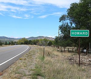
Entering Howard from the east on U.S. Route 50
|
|

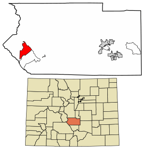
Location of the Howard CDP in Fremont County, Colorado.
|
|
| Country | |
| State | |
| County | Fremont County |
| Government | |
| • Type | unincorporated community |
| Area | |
| • Total | 16.741 sq mi (43.360 km2) |
| • Land | 16.741 sq mi (43.360 km2) |
| • Water | 0 sq mi (0.000 km2) |
| Elevation | 7,405 ft (2,257 m) |
| Population | |
| • Total | 852 |
| • Density | 50.892/sq mi (19.649/km2) |
| Time zone | UTC-7 (MST) |
| • Summer (DST) | UTC-6 (MDT) |
| ZIP code |
81233
|
| Area code(s) | 719 |
| GNIS feature | Howard CDP |
Howard is a small community in Colorado, United States. It is located in Fremont County. Howard is known as a census-designated place (CDP). This means it's an area that the government counts for population. However, it is not an officially incorporated city or town. Howard has its own post office and a ZIP Code of 81233. In 2020, about 852 people lived in Howard.
Contents
History of Howard
The Howard Post Office opened in 1882. The community was named after a local pioneer named John Howard. A pioneer is someone who is among the first to explore or settle a new area.
Geography and Location
Howard is in the southwestern part of Fremont County. It is close to the exact center of Colorado. U.S. Route 50 is a main road that goes through Howard. This road leads northwest about 13 miles (21 km) to Salida. It also goes east about 46 miles (74 km) to Cañon City. Cañon City is the main town of Fremont County. Howard is next to another community called Coaldale to its southeast.
Area and Natural Features
The Howard CDP covers an area of about 43.360 square kilometers (about 16.74 square miles). All of this area is land. The community stretches from the Arkansas River Valley. It goes up the eastern slopes of the Sangre de Cristo Range. This area is part of the San Isabel National Forest.
Population and Demographics
Demographics refers to information about a population, like how many people live in an area. The United States Census Bureau first officially defined Howard as a CDP for the United States Census 2010. A census is a count of the population.
Population Changes Over Time
The population of Howard has changed over the years. Here's how many people lived there during recent censuses:
| Howard CDP, Colorado | ||
|---|---|---|
| Year | Pop. | ±% |
| 2010 | 723 | — |
| 2020 | 852 | +17.8% |
| Source: United States Census Bureau | ||
See also
 In Spanish: Howard (Colorado) para niños
 | John T. Biggers |
 | Thomas Blackshear |
 | Mark Bradford |
 | Beverly Buchanan |


