Coelemu facts for kids
Quick facts for kids
Coelemu
|
||
|---|---|---|

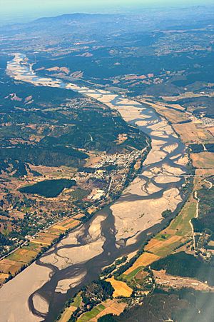
View of Itata River near Coelemu
|
||
|
||

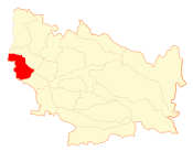
Map of the Coelemu commune in the Ñuble Region
|
||
| Country | Chile | |
| Region | Ñuble | |
| Province | Itata | |
| Government | ||
| • Type | Municipality | |
| Area | ||
| • Total | 342.3 km2 (132.2 sq mi) | |
| Elevation | 33 m (108 ft) | |
| Population
(2012 Census)
|
||
| • Total | 15,711 | |
| • Density | 45.898/km2 (118.876/sq mi) | |
| • Urban | 9,845 | |
| • Rural | 6,237 | |
| Sex | ||
| • Men | 8,086 | |
| • Women | 7,996 | |
| Time zone | UTC−4 (CLT) | |
| • Summer (DST) | UTC−3 (CLST) | |
| Area code(s) | 56 + 42 | |
| Climate | Csb | |
| Website | Municipality of Coelemu | |
Coelemu is a city and a commune (like a local area) in Chile. It is located in the Itata Province, which is part of the Ñuble Region. In 2002, about 16,082 people lived in Coelemu. The commune covers an area of about 342.3 square kilometers.
People and Places in Coelemu
A census is like a big count of all the people living in an area. According to the 2002 census, Coelemu had 16,082 residents. This included 8,086 men and 7,996 women.
Most people in Coelemu, about 9,845 (61.2%), lived in urban areas, which are like cities or towns. The rest, 6,237 people (38.8%), lived in rural areas, which are countryside areas.
Besides the main city of Coelemu, there are several smaller towns and places within the commune. These places each have fewer than 1,000 people.
- Vegas de Itata
- Guarilihue
- Caleta Burea
- Cuadrapangue
- Conai
- Magdalena
- El Pellín
- Ranquelmo
- Perales
- Dinamapu
- Meipo
How Coelemu is Governed
Coelemu is a commune, which means it's a local area with its own government. This government is run by a municipal council. The council is led by an alcalde, who is like a mayor. The alcalde is chosen by the people in an election every four years.
From 2008 to 2012, the alcalde of Coelemu was Laura Aravena Alarcón. She was part of a political group called ILE.
See also
 In Spanish: Coelemu (comuna) para niños
 | Calvin Brent |
 | Walter T. Bailey |
 | Martha Cassell Thompson |
 | Alberta Jeannette Cassell |


