Coire Gabhail facts for kids
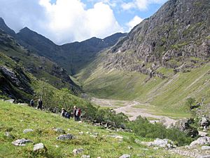
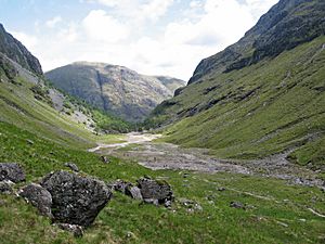
Coire Gabhail is a special high valley in the Bidean nam Bian mountains of Scotland. Many people know it as the Hidden Valley or Lost Valley of Glencoe. Its name means "Corrie of the Bounty" or "Hollow of Capture." This is because its narrow entrance, located about 230 metres (750 feet) up the hillside, hides a much wider valley inside.
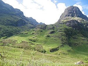
The valley runs southwest between two steep mountain ridges. On the left is Beinn Fhada, which means "Long Hill." On the right is Gearr Aonach, meaning "Short Ridge." These are two of the famous "Three Sisters" mountains. At the far end of Coire Gabhail, you'll find the peak of Stob Coire Sgreamhach.
Contents
History of the Hidden Valley
How Glaciers Shaped Coire Gabhail
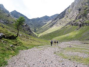
Just like Glen Coe, Coire Gabhail was formed by huge sheets of ice called glaciers. The main glacier in the glen below was much bigger and heavier. It carved out a very deep trough. When the glaciers melted, Coire Gabhail was left as a "hanging valley." This means it sits high above the main glen.
As the glaciers melted, they left behind piles of rock and dirt called moraines. These often blocked the entrances to valleys, forming lakes. Over time, the water found its way through the debris. This drained the lakes, leaving behind flat, open areas. This is why the floor of Coire Gabhail is so flat today.
Why Coire Gabhail is Called the Lost Valley
The name Coire Gabhail, or "Hollow of Capture," comes from a long time ago. Members of the Clan Macdonald used this valley to hide their cattle and other farm animals. Sometimes these animals were their own, and sometimes they had been taken from other clans. In those days, clans often took livestock from each other. Cattle were very important for their way of life. The wide, flat valley was perfect for hiding animals because from Glen Coe, it looks like a normal, narrow valley.
A Safe Place During Difficult Times
The Macdonalds often had disagreements with another group, Clan Campbell. This led to a sad event in 1692 known as the massacre of Glencoe. During a harsh winter storm, some Macdonald families had to flee their homes. Many of them found safety by escaping up into Coire Gabhail. Those who survived the night then left Glen Coe, worried that the soldiers might return.
Visiting the Hidden Valley
The Popular Walk to Coire Gabhail
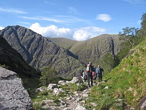
Walking into Coire Gabhail is a very popular trip for visitors. It's a short walk, about 3 kilometres (1.9 miles) each way. You climb about 230 metres (750 feet) to reach the valley. The path can be a bit rough in places. You might need to use your hands to help you balance or step up on rocks. You also cross a river by stepping on stones.
Starting Your Journey
To start the walk, you can park your car on the south side of the A82 road. This is a short distance west of a cottage called Allt-na-reigh. From the car park, a path leads down to a footbridge over the River Coe. After crossing the bridge, you'll find rough stone steps that go up beside a narrow, wooded area. Along the way, you'll see some beautiful waterfalls.
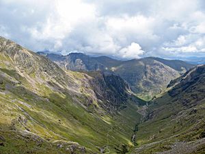
The path eventually leads you out onto a wide, flat area. This area was formed by an old landslip. From here, you get great views, and a rough path takes you to the flat floor of the valley.
Beyond the Valley Floor
For more experienced hikers, Coire Gabhail is a common starting point for climbing bigger mountains. These include Stob Coire Sgreamhach and Bidean nam Bian, which are known as Munros. A steep path climbs from the valley floor, going up the side of Gearr Aonach. This path leads to a mountain pass called Bealach Dearg. From there, you can climb up to the mountain ridge. Some hikers choose to continue exploring the mountain range and return by a different route.
 | Anna J. Cooper |
 | Mary McLeod Bethune |
 | Lillie Mae Bradford |


