
Coloma, Wisconsin facts for kids
Quick facts for kids
Coloma, Wisconsin
|
|
|---|---|

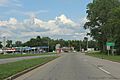
Looking west in downtown Coloma
|
|

Location of Coloma in Waushara County, Wisconsin.
|
|
| Country | |
| State | |
| County | Waushara |
| Area | |
| • Total | 1.49 sq mi (3.85 km2) |
| • Land | 1.49 sq mi (3.85 km2) |
| • Water | 0.00 sq mi (0.00 km2) |
| Elevation | 1,106 ft (337 m) |
| Population
(2010)
|
|
| • Total | 450 |
| • Estimate
(2019)
|
448 |
| • Density | 301.48/sq mi (116.37/km2) |
| Time zone | UTC-6 (Central (CST)) |
| • Summer (DST) | UTC-5 (CDT) |
| zip code |
54930
|
| Area code(s) | Area code 715 |
| FIPS code | 55-16400 |
| GNIS feature ID | 1583003 |
Coloma is a small village in Waushara County, Wisconsin, United States. In 2010, about 450 people lived there. It is part of the larger Town of Coloma. Every year, Coloma hosts a fun event called the Coloma Chicken Chew in late June.
Contents
Coloma's History
The Coloma area was first settled in 1849. Two early settlers were John Drake and a man named Stowe. Stowe built a tavern using wood that Drake had left nearby. Drake then built his own tavern from rough-hewn logs.
By 1875, the area was known as Ross Corners. This name came from the local postmaster. Later, a railroad was built between Stevens Point and Portage. It passed about four miles east of Ross Corners, at a spot called Coloma Station. The post office moved to Coloma Station. Soon, Ross Corners became known as Coloma Corners.
Where is Coloma?
Coloma is located at 44°02′00″N 89°31′16″W / 44.033421°N 89.521077°W. This means it is at 44.033421 degrees north latitude and 89.521077 degrees west longitude.
The village covers a total area of about 1.46 square miles (3.78 square kilometers). All of this area is land. There is no water within the village limits.
About 4 miles south of Coloma, you can find Glover Bluff crater. This is a special place formed by a meteor hitting the Earth long ago.
People Living in Coloma
| Historical population | |||
|---|---|---|---|
| Census | Pop. | %± | |
| 1880 | 74 | — | |
| 1940 | 308 | — | |
| 1950 | 338 | 9.7% | |
| 1960 | 312 | −7.7% | |
| 1970 | 336 | 7.7% | |
| 1980 | 367 | 9.2% | |
| 1990 | 383 | 4.4% | |
| 2000 | 461 | 20.4% | |
| 2010 | 450 | −2.4% | |
| 2019 (est.) | 448 | −0.4% | |
| U.S. Decennial Census | |||

Coloma's Population in 2010
In 2010, the village of Coloma had 450 people living there. These people lived in 184 households, and 120 of these were families. The village had about 308 people per square mile. There were 214 housing units in total.
Everyone living in the village was identified as White. About 0.9% of the population identified as Hispanic or Latino.
- Households:
- 33.7% of households had children under 18.
- 46.7% were married couples living together.
- 10.3% had a female head of household with no husband.
- 8.2% had a male head of household with no wife.
- 29.3% of households were made up of people living alone.
- 20.1% of households had someone aged 65 or older living alone.
- The average household had 2.45 people.
- The average family had 2.94 people.
The average age of people in Coloma was 39.6 years old.
- 26% of residents were under 18.
- 6.8% were between 18 and 24.
- 22.9% were between 25 and 44.
- 25.1% were between 45 and 64.
- 19.1% were 65 or older.
The population was almost evenly split between males (50.2%) and females (49.8%).
Famous People from Coloma
- Hellen M. Brooks: An educator and a Wisconsin State Representative.
- Thomas Fearne: A farmer and a Wisconsin State Senator.
- Frank Ploetz: A farmer, businessman, and Wisconsin State Representative.
- Hiram W. Roblier: A Wisconsin State Representative.
Images for kids
-
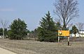
Welcome sign
-
Looking east at the sign for Coloma


See also
 In Spanish: Coloma (Wisconsin) para niños
