Colonie (village), New York facts for kids
Quick facts for kids
Colonie
|
|
|---|---|
| Village of Colonie | |
| Etymology: Dutch referring to Rensselaerswyck, the land outside of old Albany |
|

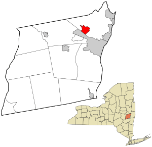
Location in Albany County and the state of New York.
|
|

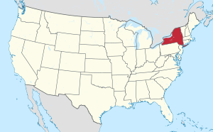
Location of New York in the United States
|
|
| Country | United States |
| State | New York |
| County | Albany |
| Incorporation as Village | March 2, 1921 |
| Area | |
| • Total | 3.25 sq mi (8.40 km2) |
| • Land | 3.24 sq mi (8.40 km2) |
| • Water | 0.00 sq mi (0.01 km2) |
| Elevation | 312 ft (95 m) |
| Population
(2020)
|
|
| • Total | 7,781 |
| • Density | 2,400.06/sq mi (926.79/km2) |
| Time zone | UTC-5 (EST) |
| • Summer (DST) | UTC-4 (EDT) |
| ZIP Code |
12205
|
| Area code(s) | 518 |
| FIPS code | 36-17332 |
| GNIS feature ID | 0947179 |
| Wikimedia Commons | Colonie, New York |
| Website | http://www.colonievillage.org |
Colonie is a small village located in Albany County, New York, United States. In 2020, about 7,781 people lived there.
The village of Colonie is part of a larger area called the town of Colonie. Both the village and the town are located north of Albany, which is the capital city of New York State.
Contents
History of Colonie Village
The village of Colonie officially became a village on March 2, 1921. Back then, it was mostly just buildings along a main road called Albany-Schenectady Road, which is now known as NY Route 5.
A few years later, in 1931, the village got its own fire department. This was an important step for keeping the community safe.
Where is Colonie Located?
Colonie is a small place, covering about 3.3 square miles (8.6 square kilometers). Most of this area is land, with only a tiny bit of water.
Nearby Places
The Village of Colonie is surrounded by several other interesting areas:
- To the north, you'll find the Shaker Historic District.
- The Albany International Airport is located to the northeast.
- To the southeast is the Hamlet of Roessleville.
- The Town of Guilderland is to the south.
- To the west, you can find the Hamlet of Karner.
- The Hamlet of Maywood is located to the northwest.
Population Changes in Colonie
The number of people living in Colonie has changed over the years. Here's a quick look at how the population has grown and shifted:
| Historical population | |||
|---|---|---|---|
| Census | Pop. | %± | |
| 1930 | 1,176 | — | |
| 1940 | 1,407 | 19.6% | |
| 1950 | 2,068 | 47.0% | |
| 1960 | 6,992 | 238.1% | |
| 1970 | 8,701 | 24.4% | |
| 1980 | 8,869 | 1.9% | |
| 1990 | 8,019 | −9.6% | |
| 2000 | 7,916 | −1.3% | |
| 2010 | 7,793 | −1.6% | |
| 2020 | 7,781 | −0.2% | |
| U.S. Decennial Census | |||
In the year 2000, there were 7,916 people living in Colonie. These people lived in 3,174 homes, and 2,253 of these were families. About 27.8% of the homes had children under 18 living there.
The average age of people in Colonie in 2000 was 41 years old. About 21.6% of the population was under 18.
Education in Colonie
Students living in the village of Colonie attend schools that are part of the South Colonie Central School District.
See also
 In Spanish: Colonie (villa) para niños
 | Charles R. Drew |
 | Benjamin Banneker |
 | Jane C. Wright |
 | Roger Arliner Young |

