Colonie, New York facts for kids
Quick facts for kids
Colonie
|
||
|---|---|---|
| Town of Colonie | ||
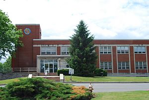
Colonie Memorial Town Hall, Newtonville, New York
|
||
|
||
| Etymology: From Dutch Colonie meaning a colony, referring to the Colony of Rensselaerswyck surrounding Albany | ||
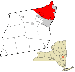
Location in Albany County and the state of New York.
|
||
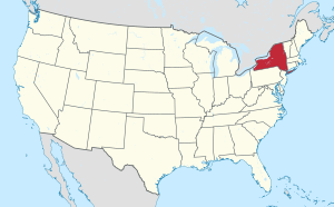
Location of New York in the United States
|
||
| Country | United States | |
| State | New York | |
| County | Albany | |
| Incorporation as town | 1895 | |
| Area | ||
| • Total | 57.84 sq mi (149.81 km2) | |
| • Land | 55.95 sq mi (144.90 km2) | |
| • Water | 1.89 sq mi (4.91 km2) | |
| Elevation | 344 ft (105 m) | |
| Highest elevation
(Locust Lane Loudonville)
|
413 ft (126 m) | |
| Lowest elevation
(sea level)
|
0 ft (0 m) | |
| Population
(2020)
|
||
| • Total | 85,590 | |
| • Density | 1,529.76/sq mi (590.68/km2) | |
| Time zone | UTC−5 (EST) | |
| • Summer (DST) | UTC−4 (EDT) | |
| ZIP Codes |
12047, 12110, 12189, 12204, 12205, 12211, 12303, 12304, 12309
|
|
| Area code(s) | 518, 838 | |
| FIPS code | 36-001-17343 | |
| FIPS code | 36-17343 | |
| GNIS feature ID | 0978853 | |
| Wikimedia Commons | Colonie, New York | |
| Website | www.colonie.org | |
Colonie is a town in Albany County, New York, United States. It's the most populated suburb of Albany. Colonie is also the third-largest town in Albany County by area.
The name "Colonie" comes from the Dutch word Colonye, which means "colony". This name refers to the large area of land called Rensselaerswyck that surrounded Albany. The town of Colonie is located north of Albany and sits at the northern edge of Albany County. Inside the town of Colonie, there are two villages: one is also called Colonie, and the other is Menands.
Contents
History of Colonie
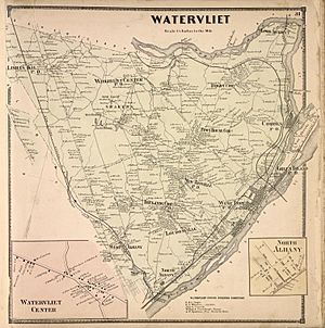
The land where Colonie is now was once part of a large estate called Rensselaerwyck. The town of Colonie was officially created in 1895. This happened because people living in the rural parts of the town of Watervliet didn't want the whole area to become a city.
A year later, the town and village of Green Island also separated from Watervliet. The part of Watervliet that remained became the city of Watervliet. Any money owed by the original town was split fairly among Green Island, Watervliet, and Colonie.
The original town of Watervliet was like the "mother of towns" in Albany County. It used to be all the land in the county outside of Albany city. All the towns you see today in Albany County were formed either directly or indirectly from Watervliet.
In the past, the central part of Colonie had large farms belonging to the Shakers, a religious community. Today, much of that land is where the Albany International Airport is located. The Watervliet Shaker Historic District is a historic site found in Colonie.
Until the 1930s, Colonie was mostly farms and small communities. After World War II, many new homes and businesses were built. This growth started along the main road connecting Albany and Schenectady. By 1980, the town was mostly developed with suburban areas.
Big highways like I-87 and I-787 were also built. These changes made Colonie a very different place from what it was in the 1930s and 1940s.
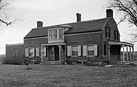
The Casparus F. Pruyn House in Newtonville is a historic home. It is now open to the public as a center for history and arts in the Town of Colonie.
Historic Places to See
Many places in Colonie are listed on the U.S. National Register of Historic Places. This means they are important historical sites. Some of these include:
- Albany Rural Cemetery
- Bacon-Stickney House
- Senator William T. Byrne House
- Frederick Cramer House
- Martin Dunsbach House
- Royal K. Fuller House
- Goodrich School
- Isaac M. Haswell House
- Hedge Lawn
- Henry-Remsen House
- Ebenezer Hills Jr. Farmhouse
- Friend Humphrey House
- John Wolf Kemp House
- John V. A. Lansing Farmhouse and Billsen Cemetery and Archeological Site
- George H. Lawton House
- Louis Menand House
- Menands Manor
- Reformed Dutch Church of Rensselaer in Watervliet
- Alfred H. Renshaw House
- Simmons Stone House
- Jedediah Strong House
- Treemont Manor
- George Trimble House
- Van Denbergh-Simmons House
- Watervliet Shaker Historic District
Geography of Colonie
Colonie covers about 57.9 square miles (149.9 square kilometers). Most of this area is land, with a small part being water.
The northern border of Colonie is next to Schenectady County and Saratoga County. The Mohawk River forms this northern boundary. To the east, the town borders Rensselaer County, with the Hudson River marking that line. Colonie is located close to where the Hudson and Mohawk rivers meet.
Major highways run through Colonie, including Interstate 87, Interstate 787, and Interstate 90. U.S. Route 9 also passes through the town. Several state routes like Route 2, Route 5, Route 7, Route 32, and Route 155 are also important roads in the town.
Colonie Population Facts
| Colonie Historical Populations | |||
|---|---|---|---|
| Census | Pop. | %± | |
| 1810 | 1,406 | — | |
| 1900 | 7,035 | — | |
| 1910 | 8,385 | 19.2% | |
| 1920 | 10,196 | 21.6% | |
| 1930 | 17,436 | 71.0% | |
| 1940 | 20,631 | 18.3% | |
| 1950 | 29,522 | 43.1% | |
| 1960 | 52,760 | 78.7% | |
| 1970 | 69,147 | 31.1% | |
| 1980 | 74,593 | 7.9% | |
| 1990 | 76,497 | 2.6% | |
| 2000 | 79,258 | 3.6% | |
| 2010 | 81,591 | 2.9% | |
| 2020 | 85,590 | 4.9% | |
| 2023 (est.) | 85,591 | 4.9% | |
| Sources: | |||
In 2020, the town of Colonie had a total population of 85,590 people. This shows a steady increase in population over many years.
In 2000, there were about 79,258 people living in Colonie. The average household had about 2.43 people. The average family size was about 3.00 people.
The population was spread out across different age groups. About 21.8% of the people were under 18 years old. About 16.3% were 65 years or older. The median age in the town was 40 years old.
In 2000, the average income for a household in Colonie was $51,817. For families, the average income was $62,649.
Education in Colonie
Colonie is served by six different public school districts. These include the South Colonie Central School District and North Colonie Central Schools. Other districts are Watervliet City School District, Menands Union Free School District, Niskayuna Central School District, and Mohonasen Central School District.
South Colonie schools, like Colonie Central High School, serve the western part of the town. North Colonie schools, including Shaker High School, serve areas like Latham and Loudonville.
The Menands Union Free School District is a smaller district. It teaches students from kindergarten through eighth grade. After eighth grade, students can choose to attend high schools in other nearby districts.
Colonie also has private and religious schools, such as the Christian Brothers Academy. Siena College, a larger school for higher education, is located in Loudonville, a hamlet within Colonie. Bryant & Stratton College is also in the town.
Fun and Recreation
The Town of Colonie has many parks and facilities for everyone to enjoy. They manage over 850 acres of land.
Some popular spots include:
- The 130-acre Crossings Park.
- The 160-acre Mohawk River Park and Pool.
- The 36-hole Town of Colonie Golf Course.
- The 43-acre Schuyler Flatts Cultural Park.
- A 5.5-mile section of the Mohawk Hudson Bike/Hike Trail.
There are also other sports fields and smaller local parks.
Media and News
Colonie has local newspapers that focus on town news. These include the Colonie Spotlight and Loudonville Spotlight.
There is also a public-access TV channel, Channel 9 on Spectrum News. This channel is dedicated to town news, programs, and events. Its studios are located at the William K. Sanford town library.
The main newspaper for the wider Capital Region, the Times Union, has its headquarters and distribution center in Colonie.
Communities and Locations
Colonie is made up of several smaller communities and hamlets:
- Albany International Airport (ALB)—This is the airport for Albany and the surrounding Capital District.
- Boght Corners—A small community in the northeastern part of the town.
- Colonie—One of the two official villages within the larger town.
- Crescent Station—A hamlet at the very northern tip of the town.
- Karner—A hamlet southwest of the village of Colonie.
- Dunsbach Ferry—A community in the northwestern part of the town, along the Mohawk River.
- Latham—A busy hamlet near the center of the town.
- Lisha Kill—A hamlet in the northwestern part of town, on Central Ave.
- Loudonville—A suburban hamlet close to the Albany city line.
- Mannsville—Part of the Schuyler Heights Fire District.
- Maplewood—A hamlet next to Cohoes, Watervliet, and Green Island.
- Maywood—A hamlet northwest of the Village of Colonie.
- Menands—The other official village in the eastern part of the town.
- Newtonville—A hamlet located between Latham and Loudonville.
- Schuyler Heights—A hamlet north of Menands and near Watervliet. It's on the west bank of the Hudson River.
- Roessleville—A suburban community close to the Albany city line.
- Shakers—A historic settlement southwest of Albany International Airport.
- Stanford Heights—A hamlet on the western edge of town, near the Schenectady County line.
- Verdoy—A hamlet north of Albany International Airport.
- West Albany—A hamlet on the southern edge of the town, along the Albany city line.
Famous People from Colonie
- Robert Prentiss, a politician from Massachusetts and New York, lived in Colonie.
- Leland Stanford, who was born in Colonie in 1824. At that time, the area was known as Watervliet.
|
See also
 In Spanish: Colonie (Nueva York) para niños
 | Sharif Bey |
 | Hale Woodruff |
 | Richmond Barthé |
 | Purvis Young |


