Green Island, New York facts for kids
Quick facts for kids
Green Island
|
|
|---|---|
| Town of Green Island Village of Green Island |
|
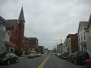
George Street looking south towards the former St. Joseph's Church
|
|
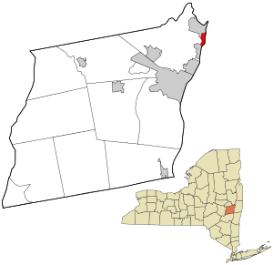
Location in Albany County and the state of New York.
|
|
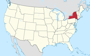
Location of New York in the United States
|
|
| Country | United States |
| State | New York |
| County | Albany |
| Incorporation as village | 1853 |
| Incorporation as town | 1896 |
| Area | |
| • Total | 0.93 sq mi (2.42 km2) |
| • Land | 0.75 sq mi (1.94 km2) |
| • Water | 0.19 sq mi (0.48 km2) |
| Elevation | 23 ft (7 m) |
| Lowest elevation | 0 ft (0 m) |
| Population
(2020)
|
|
| • Total | 2,934 |
| • Density | 3,927.71/sq mi (1,516.23/km2) |
| Time zone | UTC-5 (EST) |
| • Summer (DST) | UTC-4 (EDT) |
| ZIP Code |
12183
|
| Area code(s) | 518 |
| FIPS code | 36-001-30532 |
| FIPS code | 36-30521 |
| GNIS feature ID | 0951697 |
| Wikimedia Commons | Green Island, New York |
| Website | http://www.villageofgreenisland.com/ |
Green Island is a special place in Albany County, New York. It's unique because it's both a town and a village at the same time! This is quite rare in New York State. Green Island is located about 8 miles north of Albany.
In 2020, about 2,934 people lived here. The area's ZIP code is 12183. Even though it's called Green Island, it's actually connected to the mainland on the west side of the Hudson River. This connection was built in the 1960s. Green Island is also the smallest town in New York by land area, covering only about 0.7 square miles.
Contents
History of Green Island
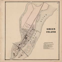
Green Island wasn't always connected to the mainland. It used to be a true island, once known as Tibbett's Island. A branch of the Mohawk River delta used to flow between the island and Watervliet, separating it from the rest of Albany County. This river branch was filled in during the 1960s when Interstate 787 was built.
Native Americans called this land Pachanhanit or Nehanenesick. They owned it until 1665, when it was sold. Later, it became part of the Manor of Rensselaerswyck. Over the years, the island was sold to different families, including the Schuylers, Oothouts, and Tibbits. In 1796, George Tibbits bought the northern part, which is how it got the name Tibbits Island.
Green Island's Industrial Past
Like its nearby cities, Green Island was once a busy center for making things and for transportation. In 1823, the Federal Dam was built between Green Island and Troy. This dam made it possible for boats to travel north on the Hudson River all year long.
In 1834, the Rensselaer and Saratoga Railroad built a station on the island. The next year, they built the first Green Island Bridge for trains, connecting Green Island to Troy. The railroad also built shops in Green Island in 1842 to build and repair locomotives and train cars. These shops were famous for trying out new ideas and materials, like lightweight steel.
Green Island became an official village in 1853, with about 800 people living there. In the same year, the Gilbert Car Company built a factory in Green Island to make railroad cars. The town of Green Island was officially formed in 1896.
Ford Motor Company and Beyond
Later, car manufacturing became important to Green Island. Thomas Edison, who had a factory nearby, introduced his friend Henry Ford to the village. In 1919, Ford and Edison even camped and fished on land in Green Island.
In 1922, The Ford Motor Company opened a plant there to make car radiators and springs. This factory was a big deal for Green Island, employing almost 1,000 people at one point. It was a great location because the Federal Dam provided cheap hydroelectric power to run the plant. The Ford plant was Green Island's biggest employer until it closed in 1989.
Even though the factory building was taken down in 2004, the dam is still active. It now produces electricity for the Green Island Power Authority (GIPA). This affordable electricity has helped bring many new businesses to Green Island, including Zak Incorporated, Honeywell Friction Materials, and the New York State Department of Taxation and Finance.
Two important historical sites in Green Island, the Rensselaer and Saratoga Railroad: Green Island Shops and St. Mark's Episcopal Church, are listed on the National Register of Historic Places.
Green Island Power Authority
Green Island is special because it has its own electric company called the Green Island Power Authority (GIPA). GIPA owns and runs a hydroelectric power plant in the Hudson River. This plant uses the power of the river to create electricity.
GIPA was created in 1986. In 2000, it took over the old Ford Plant hydroelectric dam. GIPA sells the electricity it makes and then buys cheaper hydroelectric power from Niagara Falls. This allows Green Island to offer very affordable electricity to its residents and businesses. This cheap power has been a big reason why many manufacturing and high-tech companies have moved to the area. The power plant has four turbines and can generate about six megawatts of electricity. As of 2008, GIPA's electricity rates were about 40% cheaper than those in nearby towns!
Geography of Green Island
Green Island is located at coordinates 42°44′39″N 73°41′39″W.
The village covers a total area of about 0.9 square miles. Most of this (0.7 square miles) is land, and the rest (0.2 square miles) is water.
Green Island is situated just south of where the Mohawk River flows into the Hudson River. To the west is Maplewood, a small community in the town of Colonie. To the north is the city of Cohoes. The city of Watervliet is to the southwest, and the city of Troy is to the east, across the Hudson River.
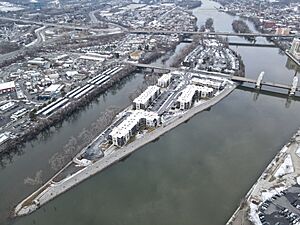
Besides the main landmass of Green Island, the village also includes two other islands: Center Island (also known as Starbuck Island) and McGill Island. Center Island has the Green Island Bridge crossing it and is located east of the mainland, right across from Downtown Troy. McGill Island is a small, uninhabited island north of Center Island that often gets flooded.
Nearby Places
 |
City of Cohoes | Mohawk River | City of Troy |  |
| Town of Colonie | Hudson River Rensselaer County |
|||
| City of Watervliet | City of Troy | City of Troy |
Population Information
| Historical population | |||
|---|---|---|---|
| Census | Pop. | %± | |
| 1860 | 1,600 | — | |
| 1870 | 3,135 | 95.9% | |
| 1880 | 4,160 | 32.7% | |
| 1890 | 4,463 | 7.3% | |
| 1900 | 4,770 | 6.9% | |
| 1910 | 4,737 | −0.7% | |
| 1920 | 4,411 | −6.9% | |
| 1930 | 4,331 | −1.8% | |
| 1940 | 3,988 | −7.9% | |
| 1950 | 4,016 | 0.7% | |
| 1960 | 3,533 | −12.0% | |
| 1970 | 3,297 | −6.7% | |
| 1980 | 2,696 | −18.2% | |
| 1990 | 2,490 | −7.6% | |
| 2000 | 2,278 | −8.5% | |
| 2010 | 2,620 | 15.0% | |
| 2020 | 2,934 | 12.0% | |
| U.S. Decennial Census | |||
According to the census from 2000, there were 2,278 people living in Green Island. There were 1,073 households, and 580 families. The population density was about 3,262 people per square mile.
Most of the people in the village (about 96.88%) were White. There were also smaller percentages of African American, Native American, and Asian residents. About 0.75% of the population was Hispanic or Latino.
About 24.9% of households had children under 18 living with them. The average household had 2.12 people, and the average family had 2.83 people.
The population's age spread showed that 21.2% were under 18 years old. The median age was 37 years. This means half the people were younger than 37 and half were older.
In 2000, the average income for a household in the village was $32,500. For families, the average income was $38,011. About 10.0% of the population lived below the poverty line.
See also
 In Spanish: Green Island (Nueva York) para niños
 | Delilah Pierce |
 | Gordon Parks |
 | Augusta Savage |
 | Charles Ethan Porter |


