Coma Pedrosa facts for kids
Quick facts for kids Coma Pedrosa |
|
|---|---|

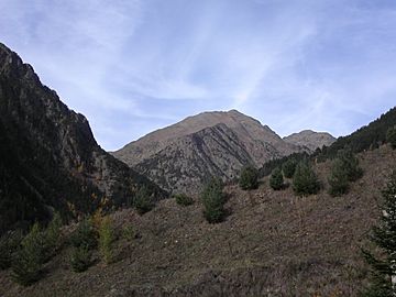
Coma Pedrosa in October 2006
|
|
| Highest point | |
| Elevation | 2,943 m (9,656 ft) |
| Prominence | 434 m (1,424 ft) |
Coma Pedrosa is the tallest mountain in Andorra, a small country in Europe. It stands at 2,943 meters (9,656 feet) high. Many people love to climb this mountain. The climb is not too difficult, but it is a good workout!
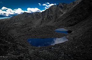
You can find several beautiful mountain lakes, called tarns, on its sides. One famous lake is Estanys de Baiau, which is actually just over the border in Spain. The closest town to Coma Pedrosa is Arinsal, which is in the area of La Massana. Long ago, this big mountain helped keep Andorra safe from invaders.
Exploring Coma Pedrosa
Coma Pedrosa looks a bit like a pyramid. It is located in the northwest part of Andorra, right on the border with France and Spain. For a long time, this mountain acted like a natural wall between Andorra and France.
Andorra is a country surrounded by land, with no coastline. It has 65 mountain peaks that are taller than 2,000 meters (6,562 feet). Coma Pedrosa is the highest of them all, reaching 2,943 meters (9,656 feet).
In recent years, more and more tourists have come to see the amazing views of these hills and valleys. The higher parts of the mountain are covered with forests. The lower parts have some farmland.
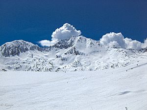
During winter, the mountain gets completely covered in snow. This makes it a great place for skiing, mountaineering, and ice climbing. In the summer, there are many easy paths for hiking. You can trek through the Arinsal valley and even reach nearby areas in Spain after crossing the Baiau mountain pass.
Fun for Visitors
Most people start their hike or climb to Coma Pedrosa from Arinsal. This is thought to be the easiest way up. The journey begins at a picnic area near the Ribal Waterfall, which is about 1,580 meters (5,184 feet) high.
It usually takes about 4 to 4.5 hours to reach the very top of Pic de Coma Pedrosa. The first part of the climb takes less than 30 minutes. You then walk up a steep hill along the Coma Pedrosa River valley. This path leads to the Coma Pedrosa camping site, which is at 2,272 meters (7,454 feet). This campsite is close to a lake called Trout Lake.
After about another hour of walking, you will reach the Black Lake. It is named for its dark color. The last part of the climb, from Estany Negre to the peak, is about one hour long. This section goes through rocky areas and can be quite challenging. The way back down follows the same path. However, some people prefer to take a different route through the Malhiverns pass, which can be more enjoyable.
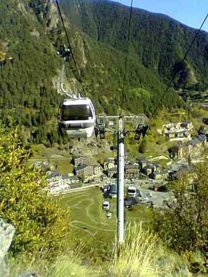
In the Arinsal valley, below Coma Pedrosa, winter is perfect for skiing and snowboarding. The first ski lifts were put in Arinsal in 1973. There is also a mountain hut called Refugi de Coma Pedrosa at 2,260 meters (7,415 feet). It opened in 1992 and offers a place for climbers to rest.
Plants and Nature
The forests on Coma Pedrosa and in its valleys have many pine, birch, and fir trees. You can also find many glacier lakes in the valleys formed by the mountains. There are also large open meadows.
Skiing has become very popular around this mountain valley near Arinsal. Because of this, many tourist resorts, hotels, restaurants, and shops have opened. This has made people realize how important it is to protect the untouched mountains and forests. To help with this, Andorra has created a network of national parks. These parks help to limit new ski resorts and other buildings, keeping the natural beauty safe.
See also
 In Spanish: Comapedrosa para niños
 | Bessie Coleman |
 | Spann Watson |
 | Jill E. Brown |
 | Sherman W. White |


