Comox Glacier facts for kids
Quick facts for kids Comox Glacier |
|
|---|---|

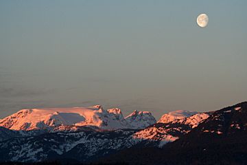
Comox Glacier on a February Morning
|
|
| Highest point | |
| Elevation | 1,960 m (6,430 ft) |
| Geography | |
| Location | Alberni-Clayoquot Regional District |
| Parent range | Vancouver Island Ranges |
| Topo map | NTS 92/F11 |
| Climbing | |
| First ascent | George Kinney, Alfred McNevin, James Tremlett and Harold Banks, August 1922 |
The Comox Glacier is a large glacier located on Vancouver Island in British Columbia, Canada. It sits about 30 kilometers (19 miles) southwest of the city of Courtenay. This amazing ice formation is a key part of the Vancouver Island Ranges.
The highest point of the Comox Glacier reaches 1,960 meters (6,430 feet) above sea level. This high spot is actually a rocky peak on the north side of the glacier. Even though it doesn't have its own official name, people often call it the Comox Glacier summit.
Contents
History of the Comox Glacier Name
The Comox Glacier gets its name from the Kʼómoks First Nation, an Indigenous group who have lived in this area for a very long time. They have their own special name for the mountain, which is Kwénis. This word means "whale" in their language.
The name Kwénis comes from an old story about a Great Flood. According to the story, a whale became stuck on the mountain when the flood waters went down. For a while in the early 1900s, the glacier was known as Dome Glacier. However, the name Comox Glacier was officially chosen in 1939. This happened because the Comox & District Mountaineering Club suggested it.
How to Reach Comox Glacier
There are a couple of main ways to get to the Comox Glacier. These routes are popular for hikers and adventurers.
Comox Glacier Trail (Frog's Pond Route)
This is the most direct path to the Comox Glacier. The trail starts where Datsio Creek meets Comox Creek. At first, the route follows a valley towards Century Sam Lake. But soon, it climbs up a ridge to the west. The trail then follows this ridge all the way to Lone Tree Pass. From there, it continues to the southern parts of the Comox Glacier.
Kookjai Route
Another way to reach the glacier is by taking the Kookjai Route. This path begins near Cougar Lake, close to the Comox Gap. It takes you over Kookjai Mountain and Black Cat Mountain. Eventually, this route joins up with the Comox Glacier Trail at Lone Tree Pass.
You can also get to the Comox Glacier by hiking from Argus Mountain, which is to the west. Or, you can climb up from Milla Lake, located to the north of the glacier.
 | Selma Burke |
 | Pauline Powell Burns |
 | Frederick J. Brown |
 | Robert Blackburn |

