Alberni-Clayoquot Regional District facts for kids
Quick facts for kids
Alberni-Clayoquot
|
||
|---|---|---|
|
Regional district
|
||
| Alberni-Clayoquot Regional District | ||
|
||

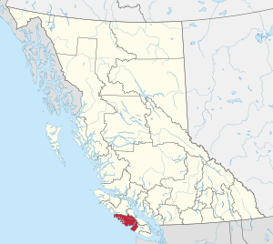
Location in British Columbia
|
||
| Country | Canada | |
| Province | British Columbia | |
| Administrative office location | Port Alberni | |
| Government | ||
| • Body | Board of Directors | |
| Area | ||
| • Land | 6,589.15 ha (16,282.14 acre) | |
| Population
(2016)
|
||
| • Total | 30,981 | |
| • Density | 4.7/km2 (12/sq mi) | |
| Website | Official website: https://www.acrd.bc.ca/ | |
The Alberni-Clayoquot Regional District is a special area in British Columbia, Canada. It is located on the west-central part of Vancouver Island. Think of it like a county or a larger local government area. It helps manage services for different communities within its borders.
In 2016, about 30,981 people lived here. The main office for the regional district is in Port Alberni. This area shares its borders with other regional districts. To the north, it's next to Strathcona and Comox Valley. To the east, it borders Nanaimo and Cowichan Valley.
Contents
Places to Live in Alberni-Clayoquot
This regional district includes different types of communities. These range from cities to smaller villages and even areas managed directly by the regional district.
Cities in the District
- Port Alberni is the main city in this regional district.
District Municipalities
These are towns that have their own local governments, but are still part of the larger regional district.
Regional District Electoral Areas
These are parts of the regional district that don't have their own city or town government. People living here vote for a director who represents them on the regional district board.
- Area A (Bamfield)
- Bamfield
- Kildonan
- Sarita
- Area B (Beaufort)
- Area C (Long Beach)
- Estevan Point
- Port Alberni
- Area D (Sproat Lake)
- Great Central
- Kleecoot
- Sproat Lake
- Area E (Beaver Creek)
- Area F (Cherry Creek)
First Nations Communities
There are also several Indian Reserves within the geographic area of the regional district. These lands are self-governed by First Nations and are not part of the regional district's local government. They have their own unique governance structures.
- Ahahswinis IR No. 1
- Alberni IR No. 2
- Anacla IR No. 12
- Clakamucus IR No. 2
- Elhlateese IR No. 2
- Esowista IR No. 3
- Hesquiat IR No. 1
- Ittatsoo IR No. 1
- Keeshan IR No. 9
- Klehkoot IR No. 2
- Macoah IR No. 1
- Marktosis IR No. 15
- Numukamis IR No. 1
- Openit IR No. 27
- Opitsat IR No. 1
- Refuge Cove IR No. 6
- Sachsa IR No. 4
- Stuart Bay IR No. 6
- Tsahaheh IR No. 1
Main Roads
The main highway that goes through the Alberni-Clayoquot Regional District is:
- Highway 4
 | Bayard Rustin |
 | Jeannette Carter |
 | Jeremiah A. Brown |

