Ucluelet facts for kids
Quick facts for kids
Ucluelet
|
|
|---|---|
|
District municipality
|
|
| District of Ucluelet | |
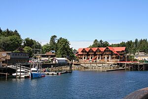
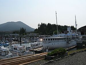
Ucluelet's public dock
|
|
| Nickname(s):
Ukee
|
|
| Country | Canada |
| Province | British Columbia |
| Region | Vancouver Island |
| Regional district | Alberni-Clayoquot Regional District |
| Incorporated | 1952 |
| Government | |
| • Type | District of Ucluelet |
| Area | |
| • Total | 6.81 km2 (2.63 sq mi) |
| • Land | 6.49 km2 (2.51 sq mi) |
| • Water | 0.32 km2 (0.12 sq mi) |
| Elevation | 20 m (70 ft) |
| Population
(2016)
|
|
| • Total | 1,717 |
| • Density | 264.5/km2 (685/sq mi) |
| Time zone | UTC−08:00 (PST) |
| Postal code span |
V0R 3A0
|
| Area code(s) | 250 |
| Highways | 4 |
| Waterways | Barkley Sound |
| Climate | Cfb |
Ucluelet (say "yoo-KLOO-let"), also known as Ukee, is a town on the Ucluelet Peninsula. It's located on the west coast of Vancouver Island in British Columbia, Canada. The name Ucluelet comes from Yuułuʔił, which means "people of the safe harbour" in the Nuu-chah-nulth language. This area is the homeland of the Yuułuʔiłʔatḥ people. In 2021, about 2,066 people lived here. This was a 20.3% increase from 2016.
Contents
Where is Ucluelet Located?
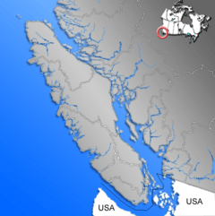
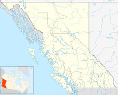
Ucluelet sits at the western edge of Barkley Sound. It is about 288 kilometers (179 miles) northwest of Victoria, the capital of British Columbia. This town is on the outer west coast of Vancouver Island.
The closest city to Ucluelet is Port Alberni, which is about 100 kilometers (62 miles) to the east. The town of Tofino is 40 kilometers (25 miles) northwest of Ucluelet along Highway 4.
Between Tofino and Ucluelet, you'll find the Long Beach part of the Pacific Rim National Park Reserve. Barkley Sound is southeast of Ucluelet. It's a marine area with the Broken Islands Group, which is also part of the Pacific Rim National Park Reserve. The community of Bamfield, known for fishing and science, is on the other side of Barkley Sound.
A Look Back at Ucluelet's History
Evidence shows that First Nations people have lived along the outer west coast of Vancouver Island for at least 4,300 years. European explorers first came to British Columbia looking for the Northwest Passage.
In 1774, Juan Pérez anchored and traded at Nootka Sound, about 100 kilometers (62 miles) north of Ucluelet. In 1775, Juan Francisco de la Bodega y Quadra sailed along the coast of Vancouver Island. He didn't stop but made a rough map of the area near Kyuquot Sound. Captain James Cook of the British Navy visited Nootka Sound in 1778. After him, fur traders arrived, like Charles William Barkley in 1787. He came to Barkley Sound near Ucluelet to find sea otter pelts.
How Ucluelet Grew
In 1870, people hunting fur seals came to the area. They needed ports for their ships working in the Bering Sea. Captain Francis, who owned several sealing ships, set up a trading post in Ucluelet harbour. Ucluelet started to grow as the sealing industry became busy. In the 1890s, more settlers arrived. They heard that a road from Port Alberni was being built. Fishing was great, and people even found some gold at Florencia Bay. However, the gold was too fine and small to be worth mining.
Artist Emily Carr spent time with First Nations communities around Ucluelet in the late 1890s. She drew pictures showing life in the village.
By 1900, more settlers had moved to the west coast of Vancouver Island. A Presbyterian Church built a Mission House and a school. A doctor also came to the area in 1898. More services and buildings started to appear. The Canadian Pacific Railway ran a small freight boat from Victoria three times a month. In 1903, a whaling station was built in Barkley Sound. In Ucluelet, the Amphitrite Point Light lighthouse, a government telegraph office, and a lifeboat station were built. When World War I began, the fishing industry was already starting to grow.
Ucluelet During Wartime
When World War II started, the Canadian government protected Vancouver Island's west coast from possible attacks. The military built a seaplane base in Ucluelet. They also set up a land base at Long Beach. The road to Tofino, which had been worked on for thirty years, was finally finished.
In 1941, the RCAF station in Ucluelet (Long Beach) helped the Royal Canadian Navy with direction finding. In 1942, navy operators from Ucluelet and other places moved to Gordon Head in Victoria.
After the war, Ucluelet continued to grow. More people came hoping for a good life. In August 1959, the long-awaited road to Port Alberni finally opened.
Ucluelet officially became a town on February 26, 1952. In 1997, its status changed to a District. This change showed that the population was growing and the town was becoming more important in the region.
What's the Weather Like in Ucluelet?
Ucluelet has an oceanic climate, like places such as Ireland. This means it has mild, rainy winters and cool summers. This is because it's right by the ocean. Temperatures rarely go below -10°C (14°F) or above 30°C (86°F).
It rains a lot in Ucluelet, about 3350 millimeters (132 inches) per year. Most of the rain falls in the winter months. However, it rains a good amount in all months, with no month getting less than 70 millimeters (2.8 inches) of rain. Even though it gets about 32.4 centimeters (12.8 inches) of snow on average, more than half the years have no snow at all! This makes Ucluelet's climate very unique in Canada.
The hottest temperature ever recorded in Ucluelet was 36.0°C (96.8°F) on June 28, 2021. The coldest temperature ever recorded was -13.9°C (7.0°F) on January 29, 1917.
| Climate data for Ucluelet, 1981–2010 normals, extremes 1914–present | |||||||||||||
|---|---|---|---|---|---|---|---|---|---|---|---|---|---|
| Month | Jan | Feb | Mar | Apr | May | Jun | Jul | Aug | Sep | Oct | Nov | Dec | Year |
| Record high °C (°F) | 16.7 (62.1) |
20.0 (68.0) |
23.5 (74.3) |
25.6 (78.1) |
29.4 (84.9) |
36.0 (96.8) |
34.0 (93.2) |
34.4 (93.9) |
30.0 (86.0) |
26.5 (79.7) |
20.0 (68.0) |
17.2 (63.0) |
36.0 (96.8) |
| Mean daily maximum °C (°F) | 8.4 (47.1) |
9.2 (48.6) |
10.3 (50.5) |
12.4 (54.3) |
15.0 (59.0) |
17.1 (62.8) |
19.0 (66.2) |
19.1 (66.4) |
18.2 (64.8) |
13.9 (57.0) |
10.4 (50.7) |
8.5 (47.3) |
13.5 (56.3) |
| Daily mean °C (°F) | 5.5 (41.9) |
5.5 (41.9) |
6.6 (43.9) |
8.4 (47.1) |
10.9 (51.6) |
13.2 (55.8) |
15.0 (59.0) |
15.0 (59.0) |
13.7 (56.7) |
10.2 (50.4) |
7.2 (45.0) |
5.5 (41.9) |
9.7 (49.5) |
| Mean daily minimum °C (°F) | 2.6 (36.7) |
1.8 (35.2) |
2.8 (37.0) |
4.3 (39.7) |
6.7 (44.1) |
9.2 (48.6) |
10.9 (51.6) |
11.0 (51.8) |
9.2 (48.6) |
6.4 (43.5) |
4.0 (39.2) |
2.6 (36.7) |
6.0 (42.8) |
| Record low °C (°F) | −13.9 (7.0) |
−11.0 (12.2) |
−7.2 (19.0) |
−5.0 (23.0) |
−3.3 (26.1) |
0.6 (33.1) |
1.7 (35.1) |
2.2 (36.0) |
−1.1 (30.0) |
−7.8 (18.0) |
−9.5 (14.9) |
−11.7 (10.9) |
−13.9 (7.0) |
| Average precipitation mm (inches) | 501.8 (19.76) |
353.1 (13.90) |
322.3 (12.69) |
266.5 (10.49) |
165.9 (6.53) |
147.2 (5.80) |
78.5 (3.09) |
87.6 (3.45) |
139.6 (5.50) |
345.3 (13.59) |
492.2 (19.38) |
451.1 (17.76) |
3,351.1 (131.93) |
| Average rainfall mm (inches) | 495.0 (19.49) |
343.8 (13.54) |
316.4 (12.46) |
265.8 (10.46) |
165.9 (6.53) |
147.2 (5.80) |
78.5 (3.09) |
87.6 (3.45) |
139.6 (5.50) |
345.2 (13.59) |
489.2 (19.26) |
444.4 (17.50) |
3,318.7 (130.66) |
| Average snowfall cm (inches) | 6.8 (2.7) |
9.3 (3.7) |
5.9 (2.3) |
0.76 (0.30) |
0.0 (0.0) |
0.0 (0.0) |
0.0 (0.0) |
0.0 (0.0) |
0.0 (0.0) |
0.05 (0.02) |
3.0 (1.2) |
6.7 (2.6) |
32.4 (12.8) |
| Average precipitation days (≥ 0.2 mm) | 22.5 | 18.8 | 21.6 | 18.2 | 15.9 | 13.8 | 9.4 | 10.0 | 12.0 | 19.2 | 22.7 | 21.7 | 205.8 |
| Average rainy days (≥ 0.2 mm) | 22.3 | 18.5 | 21.4 | 18.2 | 15.9 | 13.8 | 9.4 | 10.0 | 12.0 | 19.2 | 22.5 | 21.5 | 204.7 |
| Average snowy days (≥ 0.2 cm) | 1.8 | 2.0 | 1.5 | 0.32 | 0.0 | 0.0 | 0.0 | 0.0 | 0.0 | 0.04 | 0.65 | 1.8 | 8.0 |
| Source: Environment Canada | |||||||||||||
Who Lives in Ucluelet?
In the 2021 Canadian census, Ucluelet had a population of 2,066 people. They lived in 860 homes. The town covers a land area of 6.48 square kilometers (2.50 sq mi). This means about 318 people lived in each square kilometer in 2021.
The Yuułuʔiłʔatḥ people are very important in the local community. Their name means "people of the safe landing place" or "people of the safe harbour." Their government is located in Hitacu, which is about 28 kilometers (17 miles) from Ucluelet.
Ucluelet and nearby Tofino have become popular places for resorts, restaurants, and adventure tourism. In the past, most local jobs were in fishing and logging. Now, many people come to work in tourism and hospitality.
What are the Backgrounds of Ucluelet Residents?
Most residents in Ucluelet have European backgrounds (81%). Other groups include Indigenous people (9%), Japanese (4%), and Filipino (3%).
What Religions are Practiced in Ucluelet?
According to the 2021 Canadian census, most people in Ucluelet (70.8%) do not follow a specific religion. About 20.9% are Christian. Smaller groups include Buddhists (1.3%) and others (3.3%).
How to Get to Ucluelet
Ucluelet has an airport called Tofino Ucluelet Airport. It's about a twenty-minute drive from town. Small passenger planes can land there. The harbour in Ucluelet, called Ucluelet Water Aerodrome, is for floatplanes. In the summer, morning fog is common. This can make it hard to fly in until the weather clears.
You can drive to Ucluelet using Highway 4 from Port Alberni. From October 1 to March 31, cars must use winter tires or carry chains on this road. Tofino Bus also offers bus service to Ucluelet from Victoria, Vancouver, Nanaimo, and Port Alberni. In the summer, Lady Rose Marine Services runs a ferry from Port Alberni to Ucluelet several times a week.
Fun Things to Do in Ucluelet
Ucluelet used to rely on fishing and logging. Now, it's a popular place for tourism all year round. The Pacific Rim Visitor Centre is the second most visited tourism center on Vancouver Island. It welcomes about 90,000 visitors each year to the Pacific Rim National Park, Ucluelet, and Tofino areas.
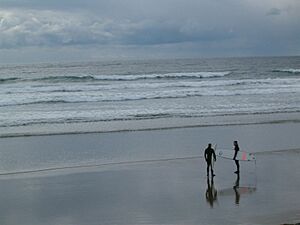
There are many fun activities for tourists. These include surfing, stand-up paddleboarding, fishing, and watching whales or bears. You can also go kayaking, canoeing, camping, hiking, biking, swimming, and beachcombing. From November to March, "storm watching" is also a popular activity.
Exciting Activities to Try
The Wild Pacific Trail starts near the Amphitrite Point Lighthouse. It goes north along the Pacific coastline through Big Beach Park. The trail is easy for all ages and even wheelchairs in some parts. Bikes, horses, or motorized vehicles are not allowed on the park's beaches or trails. The hiking trails are made to help visitors see the shoreline without harming the delicate environment.
You can take various boat tours. These include sea kayaking, canoeing in the inlet, and tours to watch whales and other wildlife. Sport fishing is very popular in Ucluelet. Many companies offer chartered fishing trips. Surfing has also become a favorite activity for both visitors and locals. In the summer, surfers gather at Florencia Bay, Wickaninnish Beach, and Long Beach in the Pacific Rim National Park Reserve.
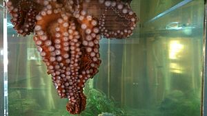
In 2012, the Ucluelet Aquarium moved into its new building on Main Street. It's a "catch-and-release" aquarium, meaning the animals are returned to the ocean. It shows off the amazing sea life found nearby, with many types of fish and other sea creatures.
Mt. Ozzard has a radar dome for the Coast Guard and other communication towers. There's a service road to the top, but it's gated at the bottom. Even so, hikers and all-terrain vehicles can still reach the summit.
Festivals and Events in Ucluelet
Every March, the Pacific Rim Whale Festival takes place. It's a week of events hosted by Ucluelet, Tofino, and the Pacific Rim National Park Reserve. The festival focuses on teaching people about protecting marine life. It celebrates the yearly return of migrating Pacific Grey Whales. They come back from their breeding areas in Mexico. The festival includes dinners, activities for kids, workshops, and live entertainment.
Every two years (on odd-numbered years), Ucluelet hosts a part of the Van Isle 360 race. This is a sailing race around Vancouver Island, done in 10 parts. When the sailors are in Ucluelet, the community holds a special salmon barbecue with live music and a send-off event.
In mid-June, there's the Annual Edge to Edge Marathon. Runners from the community and beyond race from Tofino through the Pacific Rim National Park Reserve to Ucluelet.
The Pacific Rim Summer Festival happens in early July. It's two weeks of music, spoken word, and multicultural concerts. It features performers from Canada and other countries. Concerts are held every night in Ucluelet, Tofino, and the Pacific Rim National Park Reserve.
At the end of July, or on the last weekend, is Ukee Days. This is a local celebration with several events. These include a salmon barbecue on Friday, a pancake breakfast and town parade on Saturday, and a Ukee Days dance.
 | Calvin Brent |
 | Walter T. Bailey |
 | Martha Cassell Thompson |
 | Alberta Jeannette Cassell |


