Cook County, New South Wales facts for kids
Quick facts for kids CookNew South Wales |
|||||||||||||||
|---|---|---|---|---|---|---|---|---|---|---|---|---|---|---|---|

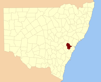
Location in New South Wales
|
|||||||||||||||

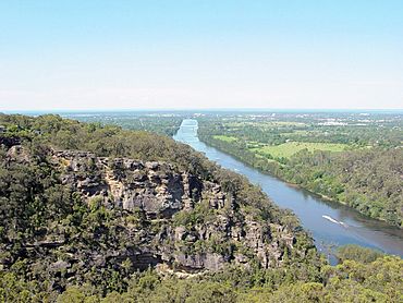
Looking north on the Nepean River near Penrith; Cook County is on the left of the river; Cumberland is on the right
|
|||||||||||||||
|
|||||||||||||||
Cook County was one of the first areas marked out in New South Wales, Australia. It's like an old-fashioned way of dividing up land. This county is mostly found in the beautiful Blue Mountains, west of Sydney. It stretches between the Colo River in the north and the Coxs River in the south and west. You'll find many well-known Blue Mountains towns here, like Lithgow, Katoomba, and Wentworth Falls. The Nepean River forms its eastern edge. Before 1834, parts of this area belonged to other counties.
Why is it Called Cook County?
This county was named after a very famous explorer, James Cook. He was a British navigator who explored and mapped many parts of the Pacific Ocean. This included the eastern coast of Australia. Captain Cook lived from 1728 to 1779. Naming places after important people was a common practice back then.
What are Parishes?
Counties in New South Wales were further divided into smaller areas called parishes. These divisions helped with land management and record-keeping in the past. Cook County contains many different parishes. Each parish has its own name and location within the county.
 | Calvin Brent |
 | Walter T. Bailey |
 | Martha Cassell Thompson |
 | Alberta Jeannette Cassell |

