Coolaburragundy River facts for kids
Quick facts for kids Coolaburragundy River |
|
|---|---|

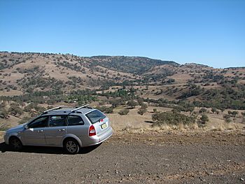
Upper valley of Coolaburragundy River, near Coolah
|
|
| Other name(s) | Coolah Creek |
| Country | Australia |
| State | New South Wales |
| Region | IBRA: Brigalow Belt South |
| District | Orana |
| Municipality | Warrumbungle |
| Physical characteristics | |
| Main source | Liverpool Range and Great Dividing Range Pandoras Pass, north-east of Coolah 656 m (2,152 ft) |
| River mouth | confluence with the Talbragar River near Leadville 286 m (938 ft) |
| Length | 68.9 km (42.8 mi) |
| Basin features | |
| River system | Murray–Darling basin |

The Coolaburragundy River is a river in New South Wales, Australia. It is sometimes called Coolah Creek. This river is part of the Talbragar River system. It also belongs to the much larger Murray–Darling basin, which is a huge area where water collects from many rivers. The river flows through the Orana district of New South Wales.
Where Does the Coolaburragundy River Start and End?
The Coolaburragundy River begins on the south-western slopes of the Liverpool Range. This area is also part of the Great Dividing Range. It starts about 15 kilometers (9.3 miles) north-east of the town of Coolah, at a place called Pandoras Pass.
Water from Coolah Tops National Park also flows into the river. As it travels, the river generally moves towards the south-west. Three smaller streams, called tributaries, join the Coolaburragundy River along its way.
The river ends when it meets the Talbragar River. This meeting point is called a confluence. It happens near the town of Leadville. From where it starts to where it ends, the river drops about 265 meters (869 feet). Its total length is about 69 kilometers (43 miles).
Water for the Valley
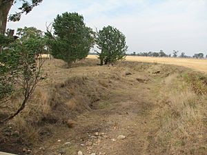
Even though the Coolaburragundy River itself can sometimes be dry, there is still water available. This is because a natural underground water storage, called an aquifer, lies beneath the Coolaburragundy valley. This aquifer stretches between Coolah and Dunedoo.
This underground water is very important. It provides enough water for some farming in the area. Farmers can grow crops on the rich, fertile soil found along the river valley.
 | Toni Morrison |
 | Barack Obama |
 | Martin Luther King Jr. |
 | Ralph Bunche |

