Liverpool Range facts for kids
Quick facts for kids Liverpool |
|
|---|---|

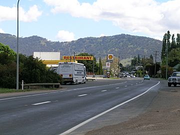
The Liverpool Range viewed from Murrurundi
|
|
| Highest point | |
| Elevation | 1,300 m (4,300 ft) |
| Dimensions | |
| Length | 100 km (62 mi) west |
| Naming | |
| Etymology | The Second Earl of Liverpool |
| Geography | |
| Country | Australia |
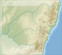
| State | New South Wales |
| Range coordinates | 32°3.2′S 151°29.6′E / 32.0533°S 151.4933°E |
| Parent range | Great Dividing Range |
The Liverpool Range is a group of mountains in New South Wales, Australia. It's also a place where old volcanoes once flowed with lava.
The eastern parts of this mountain range were the traditional lands of the Wonnarua people.
Contents
Geography of the Liverpool Range
The Liverpool Range starts at a high, flat area formed by old volcanoes. This area is known as the Barrington Tops. The range stretches about 100 kilometers (62 miles) to the west. It forms the northern edge of the Hunter Region.
Some parts of the Liverpool Range are part of the Great Dividing Range. This means they help separate rivers that flow towards the coast from those that flow inland. The western end of the Liverpool Range joins up with the Warrumbungle Range.
The Liverpool Range is known for its strong summer thunderstorms. The mountain peaks usually get snow several times each winter.
History and Exploration
The Liverpool Range was named after Robert Jenkinson, 2nd Earl of Liverpool. He was the Prime Minister of the United Kingdom when Europeans first explored this area.
The highest parts of the range are about 1,300 meters (4,265 feet) above sea level. In the early days of British settlement in New South Wales, these mountains were a big challenge for people trying to expand further inland.
Important Crossings
The first path found across the range was Pandora's Pass. It was discovered by a botanist named Allan Cunningham. This pass is located near the western end of the range, close to the town of Coolah. It is now part of Coolah Tops National Park.
Today, the New England Highway crosses the range at Nowlands Gap. This gap is also called Murrurundi Gap. It's near the eastern end of the range. The railway from Newcastle to Werris Creek goes under this pass through the Ardglen Tunnel.
Rivers and Waterways
The southern slopes of the Liverpool Range are where the Hunter River begins. Other rivers like the Pages River, which flows through Murrurundi, also start here.
On the northern slopes, the Peel River and the Mooki River get their start. The Talbragar River and the Coolaburragundy River also begin on the range. They flow southwest and join near the town of Dunedoo.
See also
 In Spanish: Montes Liverpool para niños
 | Ernest Everett Just |
 | Mary Jackson |
 | Emmett Chappelle |
 | Marie Maynard Daly |


