Pandoras Pass facts for kids
Quick facts for kids Pandoras Pass |
|
|---|---|
| Brennans Gap; Pandora's Pass | |

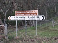
Road sign on Pandoras Pass
|
|
| Elevation | 788 m (2,585 ft) |
| Traversed by | Rockgedgiel to Pandoras Road |
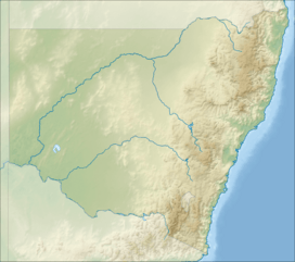
| Location | Coolah Tops National Park, New South Wales, Australia |
| Range | Warrumbungle Range, Great Dividing Range |
| Coordinates | 31°43′S 149°55′E / 31.717°S 149.917°E |
| Topo map | Coolah 8834 |
The Pandoras Pass, also known as Brennans Gap, is a mountain pass in New South Wales, Australia. It cuts through the Warrumbungle Range, which is part of the larger Great Dividing Range. You can find it inside the Coolah Tops National Park.
This pass is about 788 meters (2,585 feet) above sea level. It helps people travel between towns like Dunedoo and Coolah in the south, and Premer and the Liverpool Plains in the north.
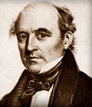
A botanist and explorer named Allan Cunningham first explored this area in 1823. He found the pass on June 9, 1823, after searching for about 50 kilometers (31 miles). The pass made it easy to get through the mountains to the Liverpool Plains. Cunningham's journey started from Bathurst in April 1823.
Today, Pandoras Pass is a quiet gravel road. Most traffic uses other routes, like the New England Highway to the east or the Black Stump Way to the west.
How Europeans Discovered Pandoras Pass
In 1823, Allan Cunningham got permission from Governor Brisbane to explore. He left Sydney on March 31, 1823, heading towards Bathurst. After getting ready, he started his journey north on April 15. He had five helpers and five strong horses to carry their supplies.
Cunningham's group passed through a place now called Rylstone. They reached the Goulburn River on May 6, 1823. The southern edge of the Liverpool Range was only about 15 kilometers (9 miles) away.
He reached a spot called Mount Macarthur (now Mount Moan). Cunningham then looked for a way through the mountains. He tried moving east along the bottom of the range. But it became too difficult with steep ravines and sharp gullies. He had to turn back to Mount Moan. This search took him three weeks and three days.
They then tried moving northwest, still looking for a passage through the Liverpool Range. After six more days, Cunningham decided to climb a western part of the range to get a better view. What he saw made him very happy! He saw a low dip in the main mountain range, about 3 kilometers (2 miles) away. This dip offered a clear view of the open plains to the north.
Cunningham named this new route Pandora's Pass. He believed it would become a very important path for travel between Bathurst, the Hunter River, and the Liverpool Plains. He returned to Bathurst through Mudgee, arriving on June 27, 1823. His tough journey had lasted eleven weeks.
Why it's Called Pandoras Pass
In his diary, Cunningham wrote about how hard it was to find this pass. He mentioned facing many difficulties, but always having "a hope at the bottom." This is why he named it Pandoras Pass.
The name comes from the ancient Greek myth of Pandora's box. In this story, Pandora opened a special jar that held all the bad things in the world. When she opened it, all the evils flew out, except for one thing: hope. Cunningham felt that even with all the challenges, hope kept him going, just like in the myth.
 | William M. Jackson |
 | Juan E. Gilbert |
 | Neil deGrasse Tyson |


