
Rylstone, New South Wales facts for kids
Quick facts for kids RylstoneNew South Wales |
|||||||||
|---|---|---|---|---|---|---|---|---|---|

St Malachy's Church Rylstone
|
|||||||||

Rylstone
Location in New South Wales
|
|||||||||
| Population | 904 (2021 census) | ||||||||
| Postcode(s) | 2849 | ||||||||
| Elevation | 582 m (1,909 ft) | ||||||||
| Location | |||||||||
| LGA(s) | Mid-Western Regional Council | ||||||||
| State electorate(s) | Bathurst | ||||||||
| Federal Division(s) | Calare | ||||||||
|
|||||||||
Rylstone is a small town in New South Wales, Australia. It's located in the Central Tablelands area, which is part of the Mid-Western Regional Council. You can find it along the Bylong Valley Way road. In 2021, Rylstone had a population of 904 people.
Contents
- What's in a Name? The Story of Rylstone
- Early Explorers and Rylstone's Beginnings
- Rylstone's History Timeline
- Special Places: Heritage Listings
- Local Government Changes
- Services in Rylstone
- Local Industries and Farming
- Fun Things to Do and See
- Tourism in Rylstone
- Mining and Resources
- Local Events
- Rylstone's Climate
- How to Get to Rylstone
- Images for kids
What's in a Name? The Story of Rylstone
The name 'Rylstone' doesn't have a clear beginning, but there are a few interesting ideas about where it came from.
- One story says that Michael Hayes, who built the Shamrock Hotel, named it. He claimed he slept on a 'Ryle Stone' (meaning 'Royal Stone' with his Irish accent) when traveling through the area.
- Another idea is that it's named after a small village called Rylstone in Yorkshire, England. Wool from the Rylstone area in Australia was sent to this part of England.
- A third tale suggests the Scots used a weapon called a 'Ryle Stone' when fighting the Picts (England). Scottish shepherds supposedly built their huts where Rylstone is now.
A group of people once asked Governor Gipps if they could name the village Tong Bong. Governor Gipps agreed to have the village surveyed, but he insisted it be called Rylstone instead. We don't know why he chose that name or if he had any connection to the English village.
Early maps sometimes spelled the town's name as Rylestone.

Early Explorers and Rylstone's Beginnings
Many early explorers and settlers traveled through this area in the 1800s. Some of them were Samuel Marsden, Macquarie, and Allan Cunningham. Several mountains in the area are named after their journeys.
In 1820, James Blackman Jr. explored a route from Bathurst to the Cudgegong River, which is where Rylstone is today.
Allan Cunningham, a botanist and explorer, wrote in his diary in 1822 that he was in the Tabrabucka area. In 1823, he passed through Dabee, which is now Rylstone.

Rylstone's History Timeline
The area was first known as Dabee. Newspapers from the 1840s and 1850s sometimes called the town Ryalston or Ryalstone.
Surveyor Davidson planned the town of Rylstone in 1846. By the 1850s, Rylstone was growing. It had a post office, hotels, a school, mills, and a police lock-up. The Rylstone district became a police district in 1854. Rylstone was officially declared a town on March 20, 1885.
The Railway Arrives

The railway line opened in Rylstone on June 9, 1884. This helped the village become a town. The railway yard had a goods shed, yards for loading animals, and a turntable (a spinning platform for trains). Interestingly, Henry Lawson's father, Niels Hertzberg Larsen, helped build the timber Rylstone railway station. The railway line was extended from Rylstone to Mudgee later that year. Rylstone is on the Gwabegar railway line.
In 1895, a telephone line was installed along the railway between Wallerawang and Mudgee, with Rylstone as a stop. This phone line was important for safety because of the steep cliffs and tunnels near Rylstone. It allowed quick communication about any problems.
The railway line through Rylstone closed in 1992 for eight years. The NSW Government spent $11 million to fix the tracks and bridges, and it reopened in 2000. However, it closed again in 2007 and remains closed. There are plans to reopen it for coal trains to travel between Cobbora Mine and power stations.
In 2017, the NSW State Government announced $1.1 million to fix the eight-kilometer rail link between Kandos and Rylstone. This will allow tourist trains to use the 'Kandos-Rylstone Rail Heritage Precinct'. Work was expected to start in April 2018.
Rylstone's Bridges

Four road bridges have crossed the Cudgegong River in Rylstone.
- The first was a suspension bridge that was washed away by floods around 1867.
- A second bridge was built soon after the flood.
- A third bridge was built in 1890.
- The fourth bridge, built in 1948, is still used today.
There's also a railway bridge over the Cudgegong River, which is the original structure from when the railway was built.
Historic Hotels
By 1868, Rylstone had four hotels: the Rylstone Hotel, Bridge View, Shamrock, and the Globe. The Rylstone and Globe Hotels are still open today. The Shamrock Hotel was built in 1885 and closed in 1890.
.jpg)

Aboriginal History
The local Aboriginal people were the Dabee tribe, who were part of the larger Wiradjuri group. Some place names in the area come from Aboriginal words:
- Lue (pronounced Loowee) means "chain of waterholes."
- Mudgee comes from Moothi, meaning "nest in the hills."
- Dabee was the name of the local Aboriginal tribe.
- Wollemi means "watch out" or "look around you."
- Cudgegong means "red hill," referring to the red clay used by Aboriginal people for body decoration.
- Tong Bong was pronounced "Tung Bung."
One of the last full-blooded Aboriginal people from the Rylstone area was Peggy Lambert, who was buried in the Rylstone Cemetery in 1884. Another local Aboriginal person was Jimmy McDonald, who worked as a tracker for the Rylstone Police station.
Early Settlers and Properties
- Richard Fitzgerald (of Dabee Station) – an Irish political prisoner who became a free settler.
- Robert Fitzgerald (Richard's son).
- Edward Cox (of Rawdon Station).
- Daniel Cox (of Balmoral, Nullo Mountain) – Daniel Cox came from England as a convict in 1830.
- John Nevell (of the property Carwell).
- John Thompson and his son William Barber Thompson (Davis Swamp Holding, later called Olinda).
- Harry Thompson (of Warleigh, near Nullo Mountain).
- Thomas Harris (of Loowee, a property that later became Lue and Monivae).
Old Buildings and Businesses
Early buildings were made from timber and bark. Later, wattle and daub (a mix of sticks and mud) became common. Because there was a lot of sandstone in the area, many important buildings were built from it.
- The Butter Factory later became the Freezing Works.
- The Rabbit Factory building was taken down.
- A Cordial Factory was built in 1880.
- The Court House and Gaol were built in 1870.
Louee Street, the main shopping street, used to have an upper and lower level. In the 1930s, the street was leveled, which is why some buildings on the high side now have tall steps.
Other Important Moments in Rylstone's Past


.jpg)
.jpg)
- 1849: The Post Office opened.
- 1853: The Wesleyan Chapel opened.
- 1857: The foundation stone for the new St James Church was laid.
- 1857: The School opened.
- 1875: Rylstone and the surrounding area had about 300 people.
- 1879: Dr Dame Constance D'Arcy, a famous doctor, was born in Rylstone.
- 1880: The Telegraph Office was built, and the Post Office moved there.
- 1894: Gold was found in the Rylstone area, leading to a gold rush.
- 1897: A 70-ounce gold nugget was found.
- 1899: Rylstone was suggested as a possible site for the new Federal Capital.
- 1903: Coal was discovered near Rylstone.
- 1906: A telephone line opened between Rylstone and Mudgee.
- 1907: Plans for an Iron and Steel factory in Rylstone were discussed.
- 1914: A 50-line telephone switchboard opened in Rylstone.
- 1915: A new telephone line was built between Rylstone and Bylong.
- 1915: Tenders were accepted to build a new hospital in Rylstone.
- 1924: A new direct telephone line was built from Lithgow to Rylstone and Mudgee.
- 1925: The Rylstone school was destroyed by fire, but no one was hurt.
- 1925: The Kandos Cement Works began construction.
- 1926: Rylstone and Kandos got electricity from the Kandos Cement Works.
- 1926: Record rainfall caused flooding.
- 1931: Rich Shale Oil was discovered in Rylstone.
- 1935: New additions to the hospital were opened.
- 1938: Discussions began about providing a water supply for Rylstone.
- 1954: A dam for water supply was completed, bringing running water to the town.
- 1960s: A sewage system was built for Rylstone.
- 1981: The last Mudgee Mail train service ran through Rylstone.
- 1983: The manual telephone switchboard closed.
- 1992: The railway line from Kandos through Rylstone to Gulgong closed.
- 2000: The railway line reopened.
- 2007: The railway line was closed again.
Special Places: Heritage Listings
Rylstone has some sites that are listed for their historical importance:
- 28–30 Louee Street: Bridge View Inn
- Wallerawang–Gwabegar railway: Rylstone railway station
Local Government Changes
The Rylstone area used to have its own local government called the Rylstone Shire Council, formed in 1906. In 2004, an investigation found problems with the council's money and staff management. All elected officials were removed, and an administrator was put in charge. In 2006, the Rylstone Shire Council joined with the Mudgee Shire Council to become the Mid Western Regional Council.
Services in Rylstone
Radio and Television
Rylstone and Kandos have a local community radio station called KRR-FM, broadcasting on 98.7 MHz. The main commercial radio station is Real-FM/2MG from Mudgee, which also broadcasts to Rylstone and Kandos on 97.9 MHz.
Television services come from the Central Tablelands and Central Western Slopes area. The main channels are CBN10 (Seven Network), CTC63 (Southern Cross 10), and WIN66 (WIN Television). The transmitters are on Mount Coombermellon32°52′19″S 149°59′25″E / 32.87194°S 149.99028°E. Because of the hills, some areas, especially north and east of Rylstone, can't get a good signal. These areas get their TV signal by satellite.
Local Industries and Farming
Rylstone is mainly a farming community. People here raise sheep for wool, cattle, and grow wine grapes and olives. Coal mining and making cement are also big employers, with these industries located in the nearby town of Kandos.
Fun Things to Do and See
- Dunns Swamp (Ganguddy): This is a great place for camping and picnics on the Cudgegong River, on the edge of Wollemi National Park. It's about 20 kilometers from Rylstone. You can go bushwalking, fishing, swimming, and canoeing. In 1929, a wall was built here to create a water storage area for the Kandos Cement Works, which is now Dunns Swamp, also known as Ganguddy.
- Ferntree Gully: This is a rainforest area about 17 kilometers north of Rylstone. Walking tracks lead you into cool, narrow valleys filled with ferns and unusual rock formations.
- Wollemi National Park: This is the second largest national park in New South Wales and has a huge wilderness area.
- Nullo Mountain: This is a high mountain plateau north of Dunns Swamp, offering amazing views over the Wollemi Wilderness and Widden Valley.
- Lake Windamere: A large dam used for water sports and fishing, with camping facilities.
- Historic Streetscape: Rylstone has kept its original old stone buildings, especially on Louee Street. Some notable buildings include the Bridge View Inn, the Globe Hotel, the post office, the police station, the courthouse, and the shire hall. The old town granary was built in the early 1840s.
Rylstone Aerodrome
Rylstone has a special area called an residential airpark for people who love flying ultralight planes, gyrocopters, and paragliding. The airstrip was sold to a private owner who plans to keep it for aviation.
Tourism in Rylstone
Rylstone is becoming a popular spot for tourists because the Bylong Valley Way road is now fully sealed. This road was started in 1950 and finished in 2009. A large part of the Bylong Valley Way goes between the Wollemi and Goulburn River National Parks. Local businesses and councils are working to promote this route for tourism. Now, you can take a tourist loop from Sydney, through the Hunter Valley, and back to Sydney via Rylstone.
Mining and Resources
The Rylstone area has many natural resources, including coal. It's part of the western coalfield. Charbon Coal Mine, about 10 km south of Rylstone, is an active mine. There are large amounts of coal in the area, mostly thermal coal used for local coal-fired power stations. The NSW Minerals Department says these resources will be developed soon.
Cement was made at the nearby Kandos Cement Works using limestone and clay from a mine 5 km east of Kandos.
Recently, explorers have found promising deposits of rare-earth elements in the area. A company is planning to study these mineral deposits further.
Local Events
The Rylstone and District Agricultural Show happens every year in late February. The first show was held in 1937. Before that, the Rylstone Horticultural Society ran shows starting in 1892.
The Rylstone Street Feast is a food and wine event held every November. Louee Street, the main street, is closed, and tables and stalls are set up. It's a chance to show off the region's local produce.
The Rylstone Classic started in 2011. It's an annual event that brings over 200 classic Mini cars to the area. The two-day event starts from the Central Coast of New South Wales and tours the scenic roads of the mid-west. It brings almost 400 tourists to Rylstone and the surrounding areas.

Rylstone's Climate
Rylstone doesn't have its own weather station, so the climate information comes from the Mudgee weather station, which is about 42 km away.
- Average temperatures in summer (December–February) are between 14 and 31 degrees Celsius.
- In winter (June–August), temperatures range from 1 to 16 degrees Celsius.
- The average yearly rainfall is about 674.4 mm.
Because Rylstone is about 130 meters higher than Mudgee, it's usually about one degree cooler and gets more rain.
| Climate data for Rylstone (Mudgee) | |||||||||||||
|---|---|---|---|---|---|---|---|---|---|---|---|---|---|
| Month | Jan | Feb | Mar | Apr | May | Jun | Jul | Aug | Sep | Oct | Nov | Dec | Year |
| Mean daily maximum °C (°F) | 31.0 (87.8) |
30.2 (86.4) |
27.8 (82.0) |
23.3 (73.9) |
18.8 (65.8) |
15.2 (59.4) |
14.4 (57.9) |
16.0 (60.8) |
19.6 (67.3) |
23.4 (74.1) |
26.9 (80.4) |
29.8 (85.6) |
23.0 (73.4) |
| Mean daily minimum °C (°F) | 15.5 (59.9) |
15.4 (59.7) |
13.0 (55.4) |
8.5 (47.3) |
5.0 (41.0) |
2.6 (36.7) |
1.3 (34.3) |
2.3 (36.1) |
4.4 (39.9) |
7.6 (45.7) |
10.8 (51.4) |
13.7 (56.7) |
8.3 (46.9) |
| Average precipitation mm (inches) | 68.0 (2.68) |
64.2 (2.53) |
50.3 (1.98) |
44.2 (1.74) |
49.3 (1.94) |
55.0 (2.17) |
53.2 (2.09) |
53.0 (2.09) |
51.5 (2.03) |
60.3 (2.37) |
61.0 (2.40) |
64.2 (2.53) |
674.4 (26.55) |
How to Get to Rylstone
By Vehicle
- From the Hunter Valley: Travel west on the Golden Highway and turn onto the Bylong Valley Way just before Sandy Hollow.
- From Ilford: Travel 2 km north on the Castlereagh Highway and turn onto the Bylong Valley Way.
By Road and Rail
By Air
- The closest commercial flights are from Mudgee Airport (56 km by road). These flights are provided by Aeropelican.
Images for kids
-
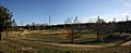
Rylstone Showground
-
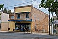
Carlton Cafe


