Cooper County, New South Wales facts for kids
Quick facts for kids CooperNew South Wales |
|||||||||||||||
|---|---|---|---|---|---|---|---|---|---|---|---|---|---|---|---|

Location in New South Wales
|
|||||||||||||||
|
|||||||||||||||
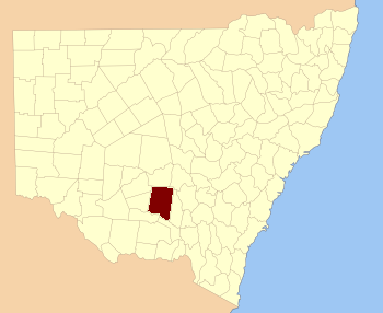
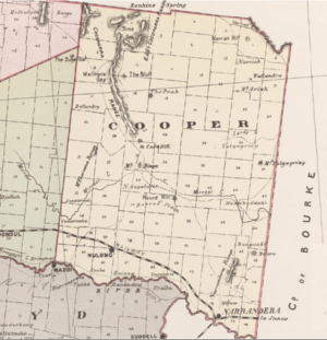
Cooper County is a special way that land is divided in New South Wales, Australia. Think of it like a big, old-fashioned map area! It's one of 141 such areas in the state. Inside Cooper County, you'll find the town of Barellan. The famous Murrumbidgee River forms the southern edge of this county.
This county was named after a very important person, Sir Daniel Cooper (1821-1902). He was a successful businessman and also a kind person who helped many charities.
What is Cooper County?
Cooper County is a "cadastral division." This is a fancy way of saying it's a land area used for official records and maps. These divisions were created a long time ago to help organize land ownership and boundaries.
New South Wales has 141 of these counties. They help people understand exactly where properties are located.
Where is Cooper County?
Cooper County is located in New South Wales, a state in Australia. It's in a part of the state that has both towns and natural features. The Murrumbidgee River is a major river that runs along its southern border.
The county is surrounded by other counties. To the north, you'll find Dowling. To the east is Bourke, and to the west is Sturt.
Parishes in Cooper County
Counties like Cooper are divided into smaller areas called "parishes." These parishes are even smaller land divisions. They help local councils manage areas and services.
Each parish in Cooper County belongs to a specific Local Government Area (LGA). An LGA is like a local council that looks after towns and communities. For example, some parishes in Cooper County are part of the Narrandera Shire Council. Others are part of the Bland Shire Council or the Carrathool Shire Council.
These parishes have names like Ariah, Barellan, and Binya. They help people know exactly which part of the county they are in.
 | Leon Lynch |
 | Milton P. Webster |
 | Ferdinand Smith |


