Corinth (village), New York facts for kids
Quick facts for kids
Corinth
|
|
|---|---|
| Village of Corinth | |

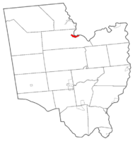
Map highlighting Corinth's location within Saratoga County.
|
|
| Country | United States |
| State | New York |
| County | Saratoga |
| Incorporation (village) | 1888 |
| Area | |
| • Total | 1.11 sq mi (2.86 km2) |
| • Land | 1.07 sq mi (2.76 km2) |
| • Water | 0.04 sq mi (0.10 km2) |
| Elevation | 610 ft (186 m) |
| Population
(2020)
|
|
| • Total | 2,562 |
| • Density | 2,401.12/sq mi (927.39/km2) |
| Time zone | UTC-5 (Eastern (EST)) |
| • Summer (DST) | UTC-4 (EDT) |
| ZIP code |
12822
|
| Area code(s) | 518 |
| FIPS code | 36-18212 |
| GNIS feature ID | 0974277 |
| Website | www.villageofcorinthny.com |
Corinth (/ˈkɒrɪnθ/ KORR-inth) is a small village in Saratoga County, New York, United States. It is located near the eastern border of the Town of Corinth. In 2020, about 2,562 people lived there. The village got its name from the ancient Greek city of Corinth. People in Corinth sometimes say it is the "Snowshoe capital of the world."
A Look Back in Time
People first came to the Corinth area in the late 1700s. They were drawn by the many waterfalls, which were a great source of power. This power was used to run mills.
Corinth officially became a village in 1888. Around that time, many paper mills were built here. These mills were very important to the village's growth and economy.
Where is Corinth?
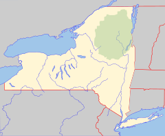
Corinth is located in New York State. It is found at coordinates 43°14′37″N 73°49′44″W / 43.24361°N 73.82889°W.
The village covers a total area of about 1.1 square miles (2.9 square kilometers). Most of this area is land, with a small part being water.
A big river called the Hudson River flows right next to the village. This river is famous in New York.
Major roads also pass through Corinth. New York State Route 9N (which is also called Maple Street and Saratoga Avenue) crosses Palmer Avenue inside the village.
How Many People Live in Corinth?
The number of people living in Corinth has changed over the years. Here is a quick look at the population from different years:
| Historical population | |||
|---|---|---|---|
| Census | Pop. | %± | |
| 1880 | 510 | — | |
| 1890 | 1,222 | 139.6% | |
| 1900 | 2,039 | 66.9% | |
| 1910 | 2,166 | 6.2% | |
| 1920 | 2,576 | 18.9% | |
| 1930 | 2,613 | 1.4% | |
| 1940 | 3,054 | 16.9% | |
| 1950 | 3,161 | 3.5% | |
| 1960 | 3,193 | 1.0% | |
| 1970 | 3,267 | 2.3% | |
| 1980 | 2,702 | −17.3% | |
| 1990 | 2,760 | 2.1% | |
| 2000 | 2,474 | −10.4% | |
| 2010 | 2,559 | 3.4% | |
| 2020 | 2,562 | 0.1% | |
| U.S. Decennial Census | |||
According to the census from the year 2000, there were 2,474 people living in the village. These people lived in 1,024 homes.
The population was spread out by age. About 26.1% of the people were under 18 years old. About 17.1% were 65 years old or older. The average age in the village was 37 years.
See also
 In Spanish: Corinth (villa) para niños
 | Victor J. Glover |
 | Yvonne Cagle |
 | Jeanette Epps |
 | Bernard A. Harris Jr. |


