Corocoro Island facts for kids
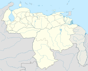
Corocoro Island (also called Isla Corocoro) is a unique island in South America. It sits near where the Amacuro River and the Barima River meet the ocean. This island is special because the northern part of the land border between Guyana and Venezuela runs right through it. This makes Corocoro Island one of the few islands in the world that is shared by more than one country.
Most of the island, about 610 square kilometers (236 square miles), belongs to Venezuela. The northern side of the island faces the Atlantic Ocean, while the southern side is next to the Barima River. Venezuela believes the entire island, which is about 689 square kilometers (266 square miles), should be part of its territory. This is because Venezuela claims the eastern part of the island as part of a disputed area called Guayana Esequiba.
Protecting Corocoro Island
The part of Corocoro Island controlled by Venezuela is a protected area. This area covers about 61,000 hectares, or 610 square kilometers. It is part of a larger natural reserve called the Imataca Reserve. This reserve helps protect the plants and animals living there. It is also part of what is known as the Coastal Protection Zone, which means it's important for keeping the coast healthy and safe.
See also
 In Spanish: Isla Corocoro para niños
- List of divided islands
 | John T. Biggers |
 | Thomas Blackshear |
 | Mark Bradford |
 | Beverly Buchanan |


