
Coto Sur facts for kids
Quick facts for kids
Coto Sur
|
|
|---|---|
|
Barrio
|
|
.jpg)
Puerto Rico Highway 149 in Coto Sur
|
|

Location of Coto Sur within the municipality of Manatí shown in red
|
|

Coto Sur
Location in Caribbean
|
|
| Commonwealth | |
| Municipality | |
| Area | |
| • Total | 6.26 sq mi (16.2 km2) |
| • Land | 6.26 sq mi (16.2 km2) |
| • Water | 0 sq mi (0 km2) |
| Elevation | 377 ft (115 m) |
| Population
(2010)
|
|
| • Total | 8,184 |
| • Density | 1,307.3/sq mi (504.8/km2) |
| Source: 2010 Census | |
| Time zone | UTC−4 (AST) |
Coto Sur is a special area called a barrio in the town of Manatí, Puerto Rico. In 2010, about 8,184 people lived there. It's a part of Puerto Rico, which is a commonwealth of the United States.
History of Coto Sur
Puerto Rico became a territory of the United States after the Spanish–American War in 1898. This happened because of a peace agreement called the Treaty of Paris of 1898.
In 1899, the United States government counted everyone living in Puerto Rico. They found that Coto Sur and a nearby area called Coto Norte had a combined population of 2,110 people.
Hurricane Maria's Impact
In 2017, a very strong storm called Hurricane Maria hit Puerto Rico. It caused a lot of damage in Coto Sur. The community center, a baseball park, and a basketball court were all destroyed.
Luckily, help arrived. In 2020, money was provided to fix these important community places. This helped the people of Coto Sur rebuild and get their facilities back.
Population over the years
The number of people living in Coto Sur has changed over time. Here's a look at the population counts from different years:
- 1940: 3,000 people
- 1950: 3,997 people
- 1980: 7,862 people
- 1990: 7,572 people
- 2000: 9,045 people
- 2010: 8,184 people
Gallery
-
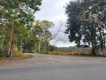
Puerto Rico Highway 672 in Coto Sur
-
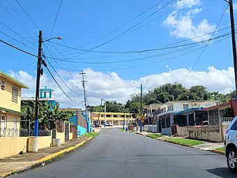
Puerto Rico Highway 6668 in Coto Sur


See also
 In Spanish: Coto Sur para niños
- List of communities in Puerto Rico
