Counter's Creek facts for kids

Counter's Creek was a stream in London, England. It started in Kensal Green and flowed south. The stream went through areas like North Kensington and Fulham. It eventually joined the famous River Thames. Today, the very last part of the stream still exists. It is now known as Chelsea Creek. This part is used as a quay, which is like a dock for boats.
Contents
Where Counter's Creek Flowed

Counter's Creek began in Kensal Green. It started from two smaller streams that met near Latimer Road. The creek then flowed south through several well-known areas. These included Kensal Green Cemetery and Little Wormwood Scrubs.
The stream passed by places like Shepherd's Bush and Olympia. It also went near Earl's Court and West Brompton. You can still see a small ditch near West Brompton Underground Station. The creek flowed past Brompton Cemetery. It also went by the Chelsea F.C. football ground, Stamford Bridge.
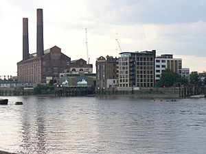
Where the creek met the River Thames, you would find the old Lots Road Power Station. This tidal mouth, or opening to the sea, is now called Chelsea Creek. It is a place where boats can dock. This area of Fulham is sometimes called "Sands End".
The History of Counter's Creek


Over time, Counter's Creek had different names. In the Middle Ages, it was called Billingwell Dyche. This name meant 'Billing's spring or stream'. The creek also formed the border between the areas of Kensington and Fulham.
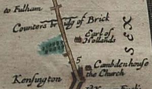
By the 1700s, it became known as Counter's Creek. This name likely came from 'Counter's Bridge'. This bridge crossed the creek at the west end of Kensington High Street. It was first mentioned in the 1300s. It might have been named after Maud, Countess of Oxford. She owned the area of Kensington long ago.
Stamford Bridge Name
The name Stamford Bridge is thought to come from 'Samfordesbrigge'. This means 'the bridge at the sandy ford'. A ford is a shallow place where you can cross a river. This is where Fulham Road crosses the stream. The current Stamford Bridge was built in 1860. It has been rebuilt a few times since then. Today, the name is mostly used for the nearby Stamford Bridge Stadium. This is the home of Chelsea F.C..
Kensington Canal and Railways
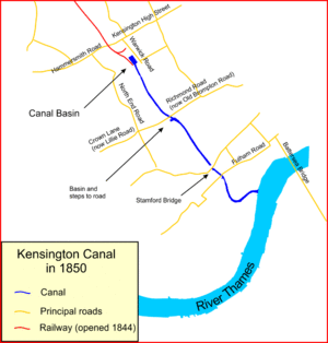
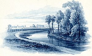
In the early 1800s (1824–1828), the lowest part of the creek was changed. It became the Kensington Canal. A canal is a man-made waterway. Later, in the 1830s, a railway company took over the canal. Much of the creek was then covered over. This allowed the West London Line railway to be built along its path. This happened between 1859 and 1863. This railway line connects Clapham Junction to Willesden Junction. It also passes through Kensington Olympia.
Only the lower part of the creek remained open. It was used to bring coal to gas works and later to Lots Road Power Station. Before the 1930s, you could still see the stream on maps. But then, drains were built to carry away surface water. Some of these drains went into the main sewer system. Others carried water separately.
Sanitation and Sewers
Since the 1800s, the dip where the creek flowed has been useful. It was used to build a large sewer system underneath it. This helped with sanitation in the area. To stop flooding, separate drains were also built. These drains carry surface water directly to the River Thames.
In the 1860s, there was a need for a new sewer. This sewer would collect waste from west of Chelsea. It would then send it to Barking. There was no easy way to build this sewer. So, it was decided to create a path for it. This also helped finish an unfinished project. This project was to extend an embankment and road to Battersea.
The government was asked for money to help with this new work. But the request was not successful. So, Sir William Tite asked the Metropolitan Board of Works to do the work without government help. The Board then asked Parliament for permission. They got it in 1868. The plans for the embankment, road, and sewer were made by Sir Joseph Bazalgette. He was the engineer for the Board. The whole project was finished and opened to the public in 1874.
 | Bayard Rustin |
 | Jeannette Carter |
 | Jeremiah A. Brown |

