Cowlington, Oklahoma facts for kids
Quick facts for kids
Cowlington, Oklahoma
|
|
|---|---|

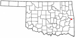
Location of Cowlington, Oklahoma
|
|
| Country | United States |
| State | Oklahoma |
| County | LeFlore |
| Area | |
| • Total | 0.91 sq mi (2.36 km2) |
| • Land | 0.91 sq mi (2.36 km2) |
| • Water | 0.00 sq mi (0.00 km2) |
| Elevation | 509 ft (155 m) |
| Population
(2020)
|
|
| • Total | 109 |
| • Density | 119.52/sq mi (46.16/km2) |
| Time zone | UTC-6 (Central (CST)) |
| • Summer (DST) | UTC-5 (CDT) |
| FIPS code | 40-17850 |
| GNIS feature ID | 2412380 |
Cowlington is a small town in LeFlore County, Oklahoma. It is part of the larger Fort Smith metropolitan area. In 2020, about 109 people lived there. This town has a rich history, especially linked to the Arkansas River.
History of Cowlington
The land where Cowlington is today was very good for farming. This attracted the Choctaw tribe to settle there when they moved to Indian Territory. Many people left during the American Civil War. But they came back after the war ended. White settlers also arrived and began to rent land. Among them were Coke and Fowler Cowling.
A small community started to grow. It was first known as Short Mountain. In 1884, a post office opened in the area. It was named Cowlington to honor the Cowling family. At that time, Cowlington was part of the Moshulatubbee District of the Choctaw Nation.
Cowlington's economy mostly depended on farming. People grew crops like wheat, potatoes, and cotton. They also raised livestock. The town did well because it could trade goods using steamboats on the Arkansas River. However, two big floods in 1898 and 1904 caused a lot of damage. The town recovered each time.
Later, railroads started to become more important than steamboats. Fowler Cowling tried to get a railroad line built through Cowlington. But he was not successful. Because of this, more people started to move away from the town.
Between 1964 and 1970, the Robert S. Kerr Lock and Dam was built nearby. This project caused Cowlington's population to grow a lot. In 1970, 751 people lived there. Tourism became a big part of the town's economy. However, after the dam was finished, the population went down again.
Where is Cowlington?
Cowlington is located about 2 miles (3.2 km) south of the Robert S. Kerr Lock and Dam. This dam is part of the McClellan-Kerr Arkansas River Navigation System. The town is also about 10.5 miles (16.9 km) south of Sallisaw.
According to the United States Census Bureau, Cowlington covers an area of about 0.9 square miles (2.3 square kilometers). All of this area is land.
People of Cowlington
| Historical population | |||
|---|---|---|---|
| Census | Pop. | %± | |
| 1900 | 272 | — | |
| 1910 | 378 | 39.0% | |
| 1920 | 344 | −9.0% | |
| 1930 | 265 | −23.0% | |
| 1940 | 224 | −15.5% | |
| 1950 | 83 | −62.9% | |
| 1960 | 74 | −10.8% | |
| 1970 | 751 | 914.9% | |
| 1980 | 546 | −27.3% | |
| 1990 | 756 | 38.5% | |
| 2000 | 133 | −82.4% | |
| 2010 | 155 | 16.5% | |
| 2020 | 109 | −29.7% | |
| U.S. Decennial Census | |||
In 2000, there were 133 people living in Cowlington. These people lived in 55 households. About 27% of households had children under 18. Many households were married couples living together.
The average age of people in Cowlington in 2000 was 36 years old. About 28% of the population was under 18. About 18% of the population was 65 years or older.
See also
 In Spanish: Cowlington (Oklahoma) para niños
 | Claudette Colvin |
 | Myrlie Evers-Williams |
 | Alberta Odell Jones |

