Coxsackie, New York facts for kids
Quick facts for kids
Coxsackie, New York
|
|
|---|---|
 |
|

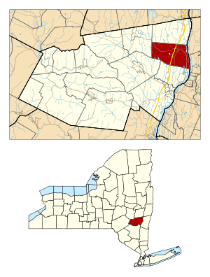
Location in Greene County and the state of New York.
|
|

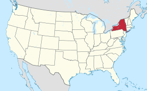
Location of New York in the United States
|
|
| Country | United States |
| State | New York |
| County | Greene |
| Area | |
| • Total | 2.59 sq mi (6.72 km2) |
| • Land | 2.17 sq mi (5.62 km2) |
| • Water | 0.42 sq mi (1.10 km2) |
| Population
(2020)
|
|
| • Total | 8,382 |
| • Density | 3,236/sq mi (1,247.3/km2) |
| Time zone | UTC-5 (EST) |
| • Summer (DST) | UTC-4 (EDT) |
| ZIP code |
12051
|
| Area code(s) | 518 |
| FIPS code | 36-039-18729 |
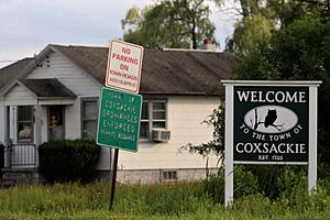
Coxsackie (pronounced kuuk-SAK-ee) is a town in Greene County, New York, United States. In 2020, about 8,382 people lived here. It's the second-largest town in Greene County.
The name "Coxsackie" comes from a Native American word. People have different ideas about what it means. One common idea is "owl's hoot."
Inside the larger area of the town, there's also a smaller place called Coxsackie Village. The town is located in the northeastern part of Greene County.
Coxsackie is also known for something interesting: the Coxsackievirus was first found here. This is a type of virus that can cause illnesses.
Contents
History of Coxsackie
Settlers first came to Coxsackie in the 1600s, around 1652. This was part of the early growth of New Netherland, which was a Dutch colony. The area became an official district in 1772.
The town of Coxsackie was officially created in 1788. Over the years, parts of Coxsackie were used to form other nearby towns. These new towns included Durham (1790), Cairo and Greenville (1803), New Baltimore (1811), and Athens (1815).
One of the first people to settle in Coxsackie was Pieter Bronck. His family name is also connected to the Bronx in New York City. In 1663, Pieter Bronck built a house in West Coxsackie. Today, this house is a museum called the Pieter Bronck House. You can visit it to learn about early life in the area. There's also a family burial ground nearby, which includes a separate section for the graves of enslaved people who worked for the family.
Geography of Coxsackie
The town of Coxsackie covers about 38.4 square miles (99.4 square kilometers). Most of this area is land, but about 1.5 square miles (3.8 square kilometers) is water.
The eastern edge of the town is along the Hudson River. This river also forms the border with Columbia County.
Major roads run through Coxsackie. The New York State Thruway (Interstate 87) and U.S. Route 9W both pass through the town. State Route 385 goes north and south through the town. This road connects older villages and areas close to the Hudson River. It used to be a big part of what was called the Coxsackie Turnpike.
People in Coxsackie
| Historical population | |||
|---|---|---|---|
| Census | Pop. | %± | |
| 1820 | 2,355 | — | |
| 1830 | 3,373 | 43.2% | |
| 1840 | 3,539 | 4.9% | |
| 1850 | 3,741 | 5.7% | |
| 1860 | 3,661 | −2.1% | |
| 1870 | 3,829 | 4.6% | |
| 1880 | 4,009 | 4.7% | |
| 1890 | 3,773 | −5.9% | |
| 1900 | 4,102 | 8.7% | |
| 1910 | 3,620 | −11.8% | |
| 1920 | 2,994 | −17.3% | |
| 1930 | 3,139 | 4.8% | |
| 1940 | 4,146 | 32.1% | |
| 1950 | 4,703 | 13.4% | |
| 1960 | 4,794 | 1.9% | |
| 1970 | 4,236 | −11.6% | |
| 1980 | 6,018 | 42.1% | |
| 1990 | 7,633 | 26.8% | |
| 2000 | 8,884 | 16.4% | |
| 2010 | 8,918 | 0.4% | |
| 2020 | 8,382 | −6.0% | |
| 2020 | |||
In 2020, the population of Coxsackie was 8,382 people. The town is home to a diverse group of people.
Places in the Town of Coxsackie
Here are some interesting communities and locations you can find in the town of Coxsackie:
- Bronck House – This historic house in West Coxsackie was built by Pieter Bronck in 1663. It is now a museum where you can learn about the past.
- Coxsackie Village – This is the main village within the town of Coxsackie.
- Reed Street Historic District – Located in Coxsackie Village, this area has many old commercial buildings from the mid-1800s. They have a special style called Italianate architecture. New businesses have recently opened here, bringing life back to this historic downtown area.
- Riverside Park – You can find this park at the end of Reed Street in Coxsackie Village. It offers amazing views of the Hudson River. There's a boat launch for motorboats, canoes, and kayaks. During summer, you can enjoy a Farmer's Market here with fresh produce, food trucks, and live music.
- Climax – A small community located northwest of Coxsackie village, along State Route 81.
- Earlton – Another small community in the western part of the town. A historic community called the Forestville Commonwealth was once located here.
- Hudson River Islands State Park – A state park with islands in the Hudson River.
- Surprise – A small community located at the very western edge of the town.
- Sleepy Hollow Lake – A lake that is partly in the southern part of the town. It's part of a resort development.
- West Coxsackie – A community located northwest of Coxsackie village on Route 81.
- Coxsackie Correctional Facility – A state prison located southwest of Coxsackie village.
- Greene Correctional Facility – Another state prison, right next to the Coxsackie Correctional Facility.
See also
 In Spanish: Coxsackie (Nueva York) para niños

