Crocodile Islands facts for kids
| Geography | |
|---|---|
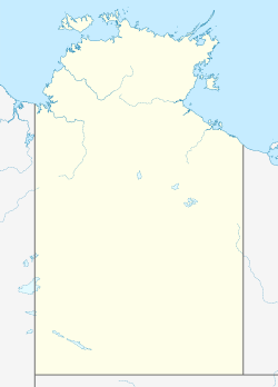
| Location | Off Arnhem Land, in the Arafura Sea |
| Coordinates | 11°56′02″S 135°04′41″E / 11.934°S 135.078°E |
| Administration | |
|
Australia
|
|
| State | Northern Territory |
The Crocodile Islands are a special group of islands in Australia. They belong to the Yan-nhaŋu people. These islands are located off the coast of Arnhem Land. You can find them in the Arafura Sea.
Contents
Discover the Crocodile Islands!
The Crocodile Islands are a chain of many different islands. Some are big, and some are small. Each island has its own unique story and importance.
Exploring the Islands
Let's look at some of the islands in this group. They are divided into larger and smaller ones.
Larger Islands
- Milingimbi Island: This island is called Yurruwi in the local language. It is the biggest of the inner islands.
- Murrungga (Mooroongga): This is the largest of the outer Crocodile Islands. It is also the birthplace of Laurie Baymarrwangga. She was the last person to speak the Yan-nhangu language fluently.
- Rapuma (Yabooma)
- Gananggananggarr (Gananggaringur)
- Nilpaywa (Crocodile Island)
Smaller Islands
- Darbada
- Boojiragi (Budjirriki)
- Mardanaingura
- Northwest Crocodile (Gurriba)
- North-east Crocodile Islands (Brul-brul)
- North-west Crocodile Reef (Gununba No 1)
A Glimpse into History
The Crocodile Islands have a long and interesting past. They were formed about 5,000 years ago. This happened when sea levels became stable.
Early Discoveries
The Dutch explorers found these islands in the 1600s. They named them the Crocodils Eÿlandt. This name means "Crocodile Island" in Dutch.
Home to Amazing Birds
Many of the Crocodile Islands are important for birds. BirdLife International has named them the Milingimbi Islands Important Bird Area (IBA). This is because many waders, or shorebirds, live here. Murrungga Island is very special. It has one of the biggest nesting and breeding sites for migratory birds in Northern Australia.
Crocodiles and Freshwater Lakes
The islands also have huge freshwater lakes. These include Garratha, Riyanhuna, and Ganbuwa. Hundreds of bird species live around these lakes. There are also many Saltwater Crocodiles. The islands are named after these amazing reptiles!
Visiting the Islands
The Crocodile Islands are a protected area. You need special permission to visit them. You must ask the local land council before planning a trip. This helps protect the islands and their unique culture.
 | Precious Adams |
 | Lauren Anderson |
 | Janet Collins |


