Croker River facts for kids
Quick facts for kids Croker River |
|
|---|---|
| Country | |
| Territory | |
| Physical characteristics | |
| River mouth | Amundsen Gulf Sea level 69°07′31″N 119°30′07″W / 69.12528°N 119.50194°W |
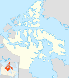
The Croker River is a river located in Northern Canada. It flows through the western part of the Kitikmeot Region in Nunavut. This river is found above the Arctic Circle, which is an imaginary line around the top of the Earth.
It is the largest river in its area that flows into the Amundsen Gulf. The Croker River is about 180 feet (55 meters) wide on average.
Where Does the Croker River Flow?
The Croker River starts at a place called Bluenose Lake. From there, it flows north towards the ocean.
Along its path, the river goes through a special type of canyon. This canyon is made of a rock called dolomite. It's like a deep, narrow valley with steep sides.
About 5 miles (8 kilometers) from the coast, the river reaches a triangular-shaped area. This area is called a delta, where the river splits into smaller streams before entering the sea. The delta is located west of Clifton Point. Finally, the Croker River flows into the Dolphin and Union Strait, which is part of the Amundsen Gulf.
Who Was the Croker River Named After?
The Croker River was named after a person named John Wilson Croker. He was an important official in the British government. His job was Secretary to the Admiralty, which meant he helped manage the British Navy.
A Look at Its History
The Croker River area has also played a role in defense. The site (known as PIN 1BG) was once part of the Distant Early Warning Line. This was a system of radar stations built to detect incoming attacks during the Cold War.
Today, the site is part of the North Warning System. This is a modern radar system that helps protect North America.
 | Isaac Myers |
 | D. Hamilton Jackson |
 | A. Philip Randolph |


