Amundsen Gulf facts for kids
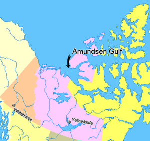
The Amundsen Gulf is a large arm of the Arctic Ocean in northern Canada. It is mostly located in the Northwest Territories, with a small part in Nunavut. This gulf sits between Banks Island and Victoria Island to the north, and the Canadian mainland to the south. It is about 400 kilometers (250 miles) long. Where it meets the Beaufort Sea, it is about 150 kilometers (93 miles) wide.
Contents
Exploring Amundsen Gulf
The Amundsen Gulf was first explored by a famous Norwegian explorer named Roald Amundsen. He explored this area between 1903 and 1906. The gulf is an important part of the famous Northwest Passage. This passage is a sea route that connects the Atlantic Ocean to the Pacific Ocean.
Where is Amundsen Gulf?
Not many people live along the shores of the Amundsen Gulf. However, there are a few small towns and communities. These include Sachs Harbour, Ulukhaktok, and Paulatuk.
The gulf connects to many other waterways in the Arctic.
- If you head north from the gulf, you would find the Prince of Wales Strait.
- Going southeast and east, the gulf leads through the Dolphin and Union Strait. It then passes Coronation Gulf.
- From there, you would go through the Dease Strait and into the Queen Maud Gulf. Eventually, you would head northeast into the Victoria Strait.
- If you travel west and northwest, you would first enter the Beaufort Sea. After that, you would reach the wider Arctic Ocean.
Climate and Ice
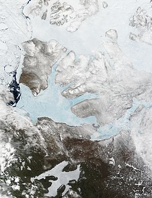
The entire Amundsen Gulf is in the Arctic tundra climate region. This means it has very cold winters. In late winter, the gulf is completely covered in thick sea ice. Most of this ice usually breaks up in July. Some parts, especially in the far eastern and northern areas, might only break up in August.
Wildlife in the Gulf
The waters of the Amundsen Gulf are home to many different animals.
- You can find Beluga whales swimming here.
- Various types of seals also live in the gulf.
- Fish like Arctic char and cod are common.
- Interestingly, sockeye and pink salmon were seen in nearby waters for the first time between 1999 and 2001.
See also
 In Spanish: Golfo de Amundsen para niños
 | Dorothy Vaughan |
 | Charles Henry Turner |
 | Hildrus Poindexter |
 | Henry Cecil McBay |


