Current River (Ontario) facts for kids
Quick facts for kids Current River |
|
|---|---|

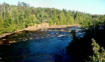
Current River seen from the Black Bay Bridge
|
|
|
Location of the mouth of the Current River in Ontario
|
|
| Country | Canada |
| Province | Ontario |
| Region | Northwestern Ontario |
| District | Thunder Bay |
| Physical characteristics | |
| Main source | Current Lake 476 m (1,562 ft) 48°46′36″N 88°56′47″W / 48.77667°N 88.94639°W |
| River mouth | Thunder Bay, Lake Superior 180 m (590 ft) 48°27′08″N 89°11′02″W / 48.45222°N 89.18389°W |
| Basin features | |
| River system | Great Lakes Basin |
| Tributaries |
|
The Current River is a river in the City of Thunder Bay and the surrounding area in Northwestern Ontario, Canada. This river is part of the Great Lakes Basin. It flows into Lake Superior, one of the largest freshwater lakes in the world. The river's name comes from the French words "Rivière aux courants", which means "river of currents." This name describes how the river flows quickly in many places.
Contents
The River's Journey
The Current River starts at Current Lake. It flows first northwest, then turns southeast. It passes over a dam at Ray Lake and goes under Ontario Highway 527. The river then reaches Onion Lake.
It continues southwest, entering a geographic area called Gorham Township. It flows past a small community named Stepstone. Then, it turns southeast before reaching the City of Thunder Bay. Here, it is joined by the North Current River from the left side.
The river then turns south and flows under Ontario Highway 17. It goes through a popular spot called Boulevard Lake and over the Boulevard Lake Dam. Finally, the Current River flows into Thunder Bay on Lake Superior.
A Look Back: History of the Current River
The name "Current River" is the English version of what early French explorers called it: "Rivière aux courants." They chose this name because of the river's strong currents.
Early Explorations and Discoveries
In 1859, Lindsay Russell, who was a Surveyor-General for Canada, explored the river. He traveled from where it meets Lake Superior towards its source. He reported that the Current River winds through steep, rocky hills. Some of these hills rise straight up from the river's edge.
Russell noted that the river is full of rapids and waterfalls. These flow through cracks in granite and slate rocks. He saw slate near the mouth of the river, but further up, he found granite.
Two other large rivers and a creek are near the Current River. These are the Neebing River, the McIntyre River, and McVicar's Creek. In the past, people sometimes called the Neebing River "First River" and the McIntyre River "Second River." This depended on whether they were looking from Fort William or Prince Arthur's Landing.
Settlement and Industry
People started to show interest in the land along the Current River in the mid-1800s. In 1857, John McKenzie bought land there. In 1865, William Petit Trowbridge bought 400 acres (162 hectares) of land near the river's mouth. This land was known to have minerals.
Around 1867, three brothers named Peter, John, and Donald McKellar found silver near the river. Their company, the Thunder Bay Silver Mining Co., operated near the river's mouth from 1866 to 1870. The buildings were destroyed by a fire. Another mine, the Duncan-Shuniah Mine, also operated in this area from 1867 to 1881.
In 1901, a dam was built near the mouth of the river. This caused the area to flood, creating an artificial lake called Boulevard Lake. The land around this new lake was turned into a public park.
Industries have continued to build near the river's mouth. These include mills that make pulp, wood, and newsprint. There are also facilities for trains and lake shipping. However, many parklands follow the river inland. Further away, the river flows through wild, roadless areas. It can be seen near roadsides and at dams built along its path.
Tributaries
- Savigny Creek (joins from the left)
- North Current River (joins from the left)
- Ferguson Creek (joins from the right)
- Bentley Creek (joins from the left)
- Wasp Creek (joins from the left)
- Onion Lake
- Barnum Creek (joins from the right)
- Aberdeen Creek (joins from the right)
- Escape Creek (joins from the left)
- Spoon Creek (joins from the right)
- Orchid Creek (joins from the left)
 | Charles R. Drew |
 | Benjamin Banneker |
 | Jane C. Wright |
 | Roger Arliner Young |


