Currumbin Creek facts for kids
Quick facts for kids Currumbin |
|
|---|---|
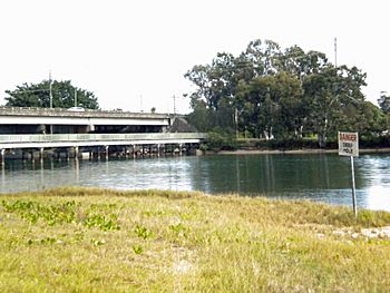
The Gold Coast Highway crossing Currumbin Creek
|
|
|
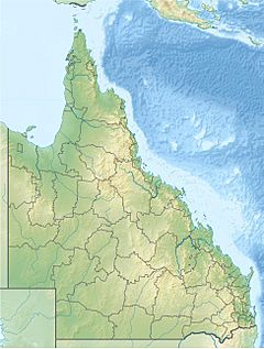
Location of the Currumbin Creek mouth in Queensland
|
|
| Country | Australia |
| State | Queensland |
| Region | South East Queensland |
| Local government area | City of Gold Coast |
| Physical characteristics | |
| Main source | Mount Cougal Gold Coast hinterland 138 m (453 ft) 28°14′20″S 153°21′57″E / 28.23889°S 153.36583°E |
| River mouth | Coral Sea Currumbin Alley, Currumbin 0 m (0 ft) 28°7′25″S 153°28′49″E / 28.12361°S 153.48028°E |
| Length | 24 km (15 mi) |
| Basin features | |
| Basin size | 489 km2 (189 sq mi) |
| National park | Springbrook National Park |
The Currumbin Creek is a small river, or creek, in Queensland, Australia. It flows through the City of Gold Coast area. Its total water collection area is about 489 square kilometers. The creek is about 24 kilometers long. It's a popular spot for many activities. People enjoy rowing, kayaking, jet skiing, boating, and fishing here.
Contents
Exploring Currumbin Creek
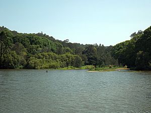
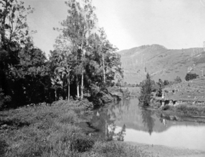
The Currumbin Creek starts in the Gold Coast hinterland. This is an area of hills and mountains behind the coast. It begins near Springbrook National Park below Mount Cougal. The creek then flows generally north and east. It passes through the Currumbin Valley.
The creek is crossed by major roads like the Pacific Motorway. It also goes under the Gold Coast Highway. Finally, it reaches its mouth at Currumbin Alley. Here, the creek empties into the Coral Sea. The creek drops 138 meters over its 24-kilometer journey.
Fun Activities and Features
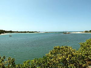
Near the mouth of the creek, at Currumbin Alley, there's a special swimming canal. It is about 100 meters long and 30 to 40 meters wide. This canal is great for swimming. It's a calm spot, unlike some other areas further inland.
Currumbin Creek has many canals, similar to Tallebudgera Creek. These canals are lined with some of the Gold Coast's most beautiful houses. The lower part of the creek is always changing. It's affected by the tides and sand moving in from the coast. Sometimes, the creek mouth gets too narrow. When this happens, sand is removed to help prevent floods.
This area is a fantastic place for outdoor fun. Many people come here to fish, swim, surf, and go boating.
Helping the Environment
The City of Gold Coast has a special program called "Beaches to Bushland." It's a volunteer program that helps restore nature. The Currumbin Creek Care Group started in 2008. This group helps plant native trees and plants. They work in the parkland along the lower parts of Currumbin Creek. This helps keep the creek healthy and beautiful.
History of the Creek
The first bridge over Currumbin Creek opened in 1926. This road was first called the Main Ocean Road. Later, it became the Pacific Highway. Today, it is known as the Gold Coast Highway.
Keeping the Creek Clear
Dredging is the process of removing sand or mud from the bottom of a waterway. This has been done at Currumbin Creek for many years. From 1974 to 1997, it happened sometimes. Since then, it has been done every year. A huge amount of sand has been removed from the creek. This sand is then used to make the beaches at Palm Beach bigger. This helps protect the coast from erosion.
In 2007, dredging made the bottom of Currumbin Alley very shallow. This created a calm, shallow area. It was perfect for families and children to play in. However, too much sand built up again. By late 2008, the Gold Coast City Council started a new project. They deepened the creek mouth again. This also helped move sand to nearby Palm Beach.
Boardwalk and Trails
There is a lovely boardwalk that winds through the Boree Bodalla Mangrove Reserve. This reserve is a small area with mangrove trees. The boardwalk has two platforms for fishing. It is also a popular path for cycling, running, and walking. It offers a peaceful setting along the creek shore.
 | Jewel Prestage |
 | Ella Baker |
 | Fannie Lou Hamer |


