Custar, Ohio facts for kids
Quick facts for kids
Custar, Ohio
|
|
|---|---|
|
Village
|
|

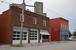
Defiance Street in central Custar
|
|

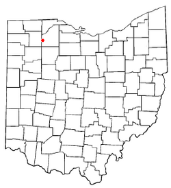
Location of Custar, Ohio
|
|

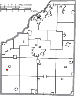
Location of Custar in Wood County
|
|
| Country | United States |
| State | Ohio |
| County | Wood |
| Township | Milton |
| Government | |
| • Type | Town council |
| Area | |
| • Total | 0.25 sq mi (0.65 km2) |
| • Land | 0.25 sq mi (0.65 km2) |
| • Water | 0.00 sq mi (0.00 km2) |
| Elevation | 692 ft (211 m) |
| Population
(2020)
|
|
| • Total | 178 |
| • Estimate
(2023)
|
178 |
| • Density | 709.16/sq mi (274.23/km2) |
| Time zone | UTC-5 (Eastern (EST)) |
| • Summer (DST) | UTC-4 (EDT) |
| ZIP code |
43511
|
| Area code(s) | 419 |
| FIPS code | 39-19750 |
| GNIS feature ID | 2398662 |
Custar is a small village located in Wood County, Ohio, in the United States. In 2020, about 178 people lived there.
Contents
History of Custar
Custar was first known as Lewisburg. It was planned out in 1865. The village was named after Frederick Lewis, who owned the land.
A post office opened in 1866 and was called Custar. The village officially became a village in 1881. In late 2019, some large grain storage buildings in Custar had an incident involving a fire and an explosion.
Geography of Custar
Custar is a small place. The United States Census Bureau says the village covers about 0.25 square miles (0.65 square kilometers). All of this area is land.
People of Custar
| Historical population | |||
|---|---|---|---|
| Census | Pop. | %± | |
| 1880 | 248 | — | |
| 1890 | 329 | 32.7% | |
| 1900 | 293 | −10.9% | |
| 1910 | 345 | 17.7% | |
| 1920 | 316 | −8.4% | |
| 1930 | 257 | −18.7% | |
| 1940 | 250 | −2.7% | |
| 1950 | 263 | 5.2% | |
| 1960 | 246 | −6.5% | |
| 1970 | 277 | 12.6% | |
| 1980 | 254 | −8.3% | |
| 1990 | 209 | −17.7% | |
| 2000 | 208 | −0.5% | |
| 2010 | 179 | −13.9% | |
| 2020 | 178 | −0.6% | |
| 2023 (est.) | 178 | −0.6% | |
| U.S. Decennial Census | |||
How Many People Live Here?
The census is a count of all the people living in a place. The 2010 census showed that 179 people lived in Custar. There were 73 households, which are groups of people living together. Out of these, 45 were families.
The village had about 716 people per square mile. Most people in Custar were White (94.4%). A small number were Native American (0.6%). Some people were from other races (2.2%) or a mix of races (2.8%). About 6.1% of the people were Hispanic or Latino.
Households and Families
In 2010, about 31.5% of households had children under 18 living there. More than half (52.1%) were married couples. Some households had a single parent. About 30.1% of households were just one person living alone.
The average household had 2.45 people. The average family had 3.13 people.
Age of Residents
The average age of people in Custar was 32.2 years old. About 25.7% of the residents were under 18. About 7.2% were between 18 and 24 years old. The largest group, 33.5%, was between 25 and 44 years old. About 10.6% of people were 65 or older.
See also
 In Spanish: Custar (Ohio) para niños
 | Dorothy Vaughan |
 | Charles Henry Turner |
 | Hildrus Poindexter |
 | Henry Cecil McBay |

