Daegu International Airport facts for kids
Quick facts for kids
Daegu International Airport
대구국제공항
大邱國際空港 Daegu Gukje Gonghang
Taegu Kukche Konghang
|
|||||||||||||||
|---|---|---|---|---|---|---|---|---|---|---|---|---|---|---|---|
 |
|||||||||||||||
| Summary | |||||||||||||||
| Airport type | Military/Public | ||||||||||||||
| Operator | Korea Airports Corporation, Republic of Korea Airforce | ||||||||||||||
| Serves | Daegu | ||||||||||||||
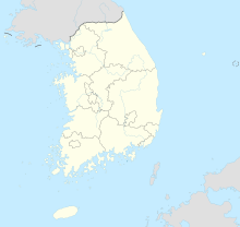
| Location | Dong District, Daegu, South Korea | ||||||||||||||
| Elevation AMSL | 116 ft / 35 m | ||||||||||||||
| Coordinates | 35°53′39″N 128°39′32″E / 35.89417°N 128.65889°E | ||||||||||||||
| Map | |||||||||||||||
| Runway | |||||||||||||||
|
|||||||||||||||
| Statistics (2018) | |||||||||||||||
|
|||||||||||||||
|
Statistics from KAC
|
|||||||||||||||
Daegu International Airport (Hangul: 대구국제공항; Hanja: 大邱國際空港) is a busy airport in Daegu, South Korea. It handles both civilian flights and military aircraft. The airport is located in the Dong District of Daegu.
It is an important hub for travel in the southeastern part of South Korea. Many people use it to fly to different cities. The airport also plays a role in moving goods.
Contents
What is Daegu International Airport?
Daegu International Airport is a special kind of airport. It is used by both regular people and the military. This means you might see passenger planes and military jets there. It is managed by the Korea Airports Corporation. The Republic of Korea Air Force also uses it.
Where is the Airport Located?
The airport is in the city of Daegu, South Korea. Daegu is a large city. The airport's exact location is at 35°53′39″N 128°39′32″E. This is in the Dong District of the city.
How Big is Daegu Airport?
Daegu International Airport has two main runways. One runway is about 2,743 meters (8,999 feet) long. The other is slightly longer, at 2,755 meters (9,039 feet). Both runways are made of concrete. One also has asphalt.
The airport is about 35 meters (116 feet) above sea level. This is not very high.
Airport Activity and Traffic
Daegu International Airport is quite busy. In 2018, over 4 million passengers used the airport. That's a lot of people!
How Many Planes Use the Airport?
In 2018, there were about 26,800 aircraft movements. This means planes took off or landed that many times.
How Much Cargo Does it Handle?
The airport also moves a lot of cargo. In 2018, it handled over 33,000 tonnes of cargo. This includes goods and packages.
History of Daegu Airport
Daegu International Airport has a long history. It was established in 1937. The airport played an important role during the Korean War.
Daegu Airport During the Korean War
During the Korean War (1950-1953), Daegu Airport was a key air base. It was used by military planes. These planes helped with many operations during the war.
You can see old photos of military aircraft from that time. Planes like the F-84E Thunderjet and F-86F Sabre used the airport. It was also used to transport people who were injured.
Images for kids
-
An F-86F of the 12th Fighter-Bomber Squadron at Taegu in 1952
See also
 In Spanish: Aeropuerto Internacional de Daegu para niños
 | Valerie Thomas |
 | Frederick McKinley Jones |
 | George Edward Alcorn Jr. |
 | Thomas Mensah |


