Damariscotta (CDP), Maine facts for kids
Quick facts for kids
Damariscotta, Maine
|
|
|---|---|

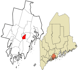
Location in Lincoln County and the state of Maine
|
|
| Country | United States |
| State | Maine |
| County | Lincoln |
| Town | Damariscotta |
| Area | |
| • Total | 4.13 sq mi (10.70 km2) |
| • Land | 3.46 sq mi (8.95 km2) |
| • Water | 0.68 sq mi (1.75 km2) |
| Elevation | 40 ft (10 m) |
| Population
(2020)
|
|
| • Total | 1,193 |
| • Density | 345.20/sq mi (133.26/km2) |
| Time zone | UTC-5 (Eastern (EST)) |
| • Summer (DST) | UTC-4 (EDT) |
| ZIP code |
04543
|
| Area code(s) | 207 |
| FIPS code | 23-16200 |
| GNIS feature ID | 2652331 |
Damariscotta is a small community in Maine, a state in the United States. It's part of a larger area called a census-designated place (CDP). This means it's a special area defined by the government for counting people.
Damariscotta is located in Lincoln County. In 2020, about 1,193 people lived in this part of Damariscotta. The entire town of Damariscotta had a population of 2,218 in 2010.
Where is Damariscotta?
The Damariscotta CDP is in the western part of the town of Damariscotta. This area is in the middle of Lincoln County.
To the south, it reaches the border of a town called Bristol. The western edge of Damariscotta is the middle of the Damariscotta River. This river also forms the border with the town of Newcastle.
The community stretches north to U.S. Route 1. To the east, it goes up to a power line, which is near Heater Road.
Roads and Travel
A special road called U.S. Route 1 Business goes right through the center of Damariscotta. It is known as Main Street. The main U.S. Route 1 goes around Damariscotta to the north.
- US 1 goes northeast about 25 miles (40 km) to Rockland.
- It goes southwest about 18 miles (29 km) to Bath.
- The big city of Portland is about 52 miles (84 km) to the southwest.
Two other important roads, Maine Route 129 and Maine Route 130, start in Damariscotta. They both head south out of the community.
- In Bristol, they split up.
- ME 129 goes south-southwest about 13 miles (21 km) to South Bristol.
- ME 130 goes south-southeast about 14 miles (23 km) to Pemaquid Point.
Land and Water
The Damariscotta CDP covers a total area of about 4.13 square miles (10.7 square kilometers).
- Most of this area, about 3.46 square miles (8.95 square kilometers), is land.
- The rest, about 0.68 square miles (1.75 square kilometers), is water.
- This means about 16.36% of the area is water.
People in Damariscotta
The number of people living in Damariscotta has changed over time. Here's a quick look at the population:
| Historical population | |||
|---|---|---|---|
| Census | Pop. | %± | |
| 2020 | 1,193 | — | |
| U.S. Decennial Census | |||
In 2020, the population of the Damariscotta CDP was 1,193 people.
See also
 In Spanish: Damariscotta para niños

