Dangarsleigh, New South Wales facts for kids
Quick facts for kids DangarsleighNew South Wales |
|
|---|---|

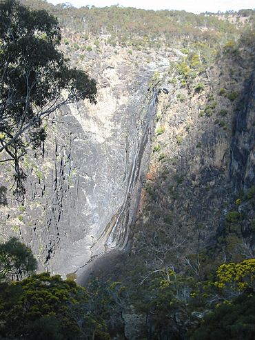
Dangars Falls and Gorge
|
|
| Population | 97 (2006 census) |
| Postcode(s) | 2350 |
| Elevation | 1,020 m (3,346 ft) |
| LGA(s) | Armidale Regional Council |
| County | Sandon |
| State electorate(s) | Northern Tablelands |
| Federal Division(s) | New England |
Dangarsleigh is a small country area located about 11 kilometers southeast of Armidale, New South Wales. It sits high up, about 1,020 meters above sea level. You can find Dangarsleigh in the Northern Tablelands part of the New England region, in New South Wales, Australia.
The name Dangarsleigh remembers an important surveyor and farmer named Henry Dangar. This area is part of the Armidale Regional Council and Sandon County. In 2006, about 97 people lived in Dangarsleigh.
Discovering Dangarsleigh
Dangarsleigh is a quiet place with some interesting spots to visit. It's known for its beautiful natural scenery and a special memorial.
A Special Memorial
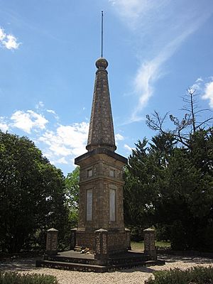
At the main road junction in Dangarsleigh, you'll find a war memorial. This memorial was put up by the Perrot family. It honors their oldest son, Harold, who sadly died during the First World War at a place called Passchendaele Ridge. It's a way to remember his bravery and sacrifice.
Dangars Falls
One of the most amazing natural sights here is Dangars Falls. These falls are about 16 kilometers southeast of Armidale. Here, the Salisbury Waters drops a huge 120 meters into a deep gorge below!
These falls used to be called Gostwick Falls. They are also known as Dangarsleigh Falls. You can find them inside the Oxley Wild Rivers National Park, right at the start of Dangars Gorge.
It's easy to get Dangars Falls mixed up with another waterfall called Dangar Falls. That one is near Dorrigo, which is about 125 kilometers to the east.
 | George Robert Carruthers |
 | Patricia Bath |
 | Jan Ernst Matzeliger |
 | Alexander Miles |


