Davoust River facts for kids
Quick facts for kids Davoust |
|
|---|---|

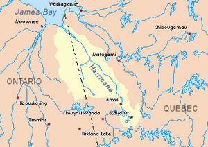
Harricana River basin in yellow
|
|
| Country | Canada |
| Province | Quebec |
| Region | Eeyou Istchee Baie-James (municipality) |
| Physical characteristics | |
| Main source | Lake Mouilliers Eeyou Istchee Baie-James (municipality), Nord-du-Québec, Quebec 244 m (801 ft) 50°44′54″N 79°52′00″W / 50.74833°N 79.86667°W |
| River mouth | Nottaway River Eeyou Istchee Baie-James (municipality), Nord-du-Québec, Quebec 0 m (0 ft) 50°44′54″N 77°52′00″W / 50.74833°N 77.86667°W |
| Length | 19.8 km (12.3 mi) |
The Davoust River is a small river in Quebec, Canada. It flows into the Nottaway River, which is a much larger river. The Davoust River is located in a part of Quebec called Eeyou Istchee Baie-James (municipality), in the Nord-du-Québec region.
This river flows mostly through forests and marshy areas. It's found to the east of Lake Dusaux. During the colder months, from early November to mid-May, the river's surface is usually frozen. It's generally safe to travel on the ice from mid-November to mid-April. There's also a forest road nearby, on the east side of Mouliers Lake.
Contents
Where Does the Davoust River Flow?
The Davoust River is surrounded by other lakes and rivers. Here's a look at the areas around it:
- North: You'll find Desorsons Lake, Rodayer Lake, Chaboullie Lake, and the Utamikaneu River.
- East: This side has Kapitastikweyack Creek, the Pauschikushish River, and the Matawawaskweyau River.
- South: To the south are Katutupisisikanuch Lake and the main Nottaway River.
- West: On the west side, you'll see Dusaux Lake and the Nottaway River again.
Starting Point of the River
The Davoust River begins at a lake called Mouliers Lake. This lake is about 2.9 kilometres (1.8 mi) long and 2.4 kilometres (1.5 mi) wide. It sits at an elevation of 244 metres (801 ft) above sea level.
The River's Journey
From Mouliers Lake, the Davoust River travels for about 19.8 kilometres (12.3 mi) (which is about 12 miles). Here's how its journey unfolds:
- First, it flows for 6.9 kilometres (4.3 mi) towards the northwest.
- Then, it turns west and flows for 5.4 kilometres (3.4 mi) until it reaches the east side of Davoust Lake.
- The river then crosses Davoust Lake, flowing southwest for 2.0 kilometres (1.2 mi). Davoust Lake is about 2.4 kilometres (1.5 mi) long and is 213 metres (699 ft) above sea level.
- Finally, it flows another 5.5 kilometres (3.4 mi) west until it reaches its mouth.
Where the River Ends
The Davoust River empties into the Nottaway River. Its mouth is located:
- About 119.3 kilometres (74.1 mi) northwest of the town of Matagami.
- About 96.4 kilometres (59.9 mi) southeast of where the Nottaway River meets Rupert Bay, which is connected to James Bay.
- About 61.6 kilometres (38.3 mi) northwest of the mouth of Soscumica Lake.
- About 83.3 kilometres (51.8 mi) east of the border with Ontario.
Name of the River
The name "Davoust River" was officially recognized on December 5, 1968. This was done by the Commission de toponymie du Quebec, which is the organization in Quebec responsible for naming places.
 | Delilah Pierce |
 | Gordon Parks |
 | Augusta Savage |
 | Charles Ethan Porter |

