Dawson Falls facts for kids
Quick facts for kids Dawson Falls |
|
|---|---|
 |
|
| Lua error in Module:Infobox_mapframe at line 185: attempt to index field 'wikibase' (a nil value). | |
| Location | Wells Gray Provincial Park, British Columbia, Canada |
| Coordinates | 51°58′00″N 120°07′00″W / 51.96667°N 120.11667°W |
| Type | Block |
| Total height | 18 metres (59 ft) |
| Number of drops | 1 |
| Total width | 107 metres (351 ft) |
| Average width | 91 metres (299 ft) |
| Run | 30 m (98 ft) |
| Watercourse | Murtle River |
| Average flow rate |
107 m3/s (3,800 cu ft/s) |
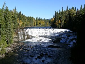
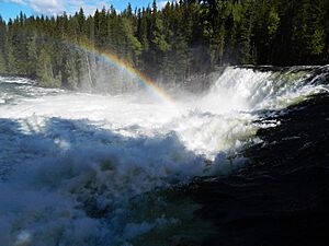
Dawson Falls is an impressive waterfall located in Wells Gray Provincial Park in British Columbia, Canada. It is one of seven amazing waterfalls found along the Murtle River. This park is well-known for its stunning natural beauty and powerful waterfalls.
Contents
Why is it called Dawson Falls?
Dawson Falls got its name in 1913. A land surveyor named Robert Henry Lee named it after George Herbert Dawson. George Dawson was the Surveyor-General for British Columbia from 1912 to 1917.
Robert Lee and his team camped near Dawson Falls in 1913 and 1914. They were surveying land for new settlers along the Murtle River. During this time, on July 24, 1913, Lee also discovered another famous waterfall, Helmcken Falls.
Exploring Dawson Falls
The main road through Wells Gray Park, called Clearwater Valley Road, passes very close to Dawson Falls. You can easily walk to the main viewing spot in about 10 minutes. It takes just a few more minutes to reach the very top of the waterfall.
There is also a rough path on the north side of the Murtle River. This path gives you a different view of the falls. If you want to camp, Pyramid Campground is nearby. It's one of four campgrounds in Wells Gray Park and has 50 campsites.
How Dawson Falls was Formed
Dawson Falls was created when the Murtle River flowed over ancient lava. This lava hardened about 200,000 years ago. Below the hard lava, there are layers of sand and gravel. These layers were left by a river that existed even before the lava erupted.
The Mushbowl
About 600 meters (2,000 feet) downstream from Dawson Falls, you'll find a spot called The Mushbowl. Here, the Murtle River drops about 5 meters (16 feet). The water splits around a rock in the middle. This waterfall exists because of a very old type of rock called Cambrian rock, which is very strong and resists erosion.
The Wells Gray Park road crosses the Murtle River right at The Mushbowl. The swirling water here has carved a small cave into the cliff on the south side. You can sometimes enter this cave when the water levels are low, usually from July onwards. The name "The Mushbowl" was given to this spot before 1940. It's a great description of how the water swirls and churns!
 | Sharif Bey |
 | Hale Woodruff |
 | Richmond Barthé |
 | Purvis Young |


