Day Island (California) facts for kids

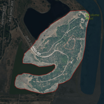
USGS aerial imagery of Day Island
|
|
| Geography | |
|---|---|
| Location | Northern California |
| Coordinates | 38°06′13″N 122°29′26″W / 38.10361°N 122.49056°W |
| Adjacent bodies of water | San Pablo Bay |
| Highest elevation | 105 ft (32 m) |
| Administration | |
|
United States
|
|
| State | |
| County | Marin |
Day Island is a small, interesting island located in San Pablo Bay. This bay is a large part of the famous San Francisco Bay in California. The island sits right where the Petaluma River flows into the bay.
It is officially part of Marin County, which is in Northern California. Day Island is a natural landmark in this busy waterway.
Where is Day Island?
Day Island is found at these exact coordinates: 38°06′13″N 122°29′26″W / 38.10361°N 122.49056°W. This helps people pinpoint its location on a map.
It's positioned at the mouth of the Petaluma River. This river is important for local wildlife and the surrounding environment.
How High is Day Island?
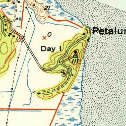
In 1981, the United States Geological Survey (USGS) measured the island's elevation. They found that Day Island rises about 105 ft (32 m) above sea level. This makes it a noticeable feature in the bay.
What Makes Day Island Special?
Even though it's a small island, Day Island plays a role in the local ecosystem. Islands like this can provide habitats for birds and other wildlife. They are also important for understanding the geography of the bay.
Its location at the river's mouth means it's part of a dynamic area. Here, fresh river water mixes with the salty bay water. This creates a unique environment for plants and animals.
 | Jessica Watkins |
 | Robert Henry Lawrence Jr. |
 | Mae Jemison |
 | Sian Proctor |
 | Guion Bluford |


