De Graff, Kansas facts for kids
Quick facts for kids
De Graff, Kansas
|
|
|---|---|

|
|
| Country | United States |
| State | Kansas |
| County | Butler |
| Township | Lincoln |
| Elevation | 1,401 ft (427 m) |
| Time zone | UTC-6 (CST) |
| • Summer (DST) | UTC-5 (CDT) |
| Area code | 620 |
| FIPS code | 20-17325 |
| GNIS ID | 474396 |
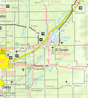
De Graff is a small, quiet community in Butler County, Kansas, United States. It's not a city or town with its own government. Instead, it's an "unincorporated community." This means it's a place where people live, but it's managed by the larger county government. You can find De Graff along U.S. Route 77, about 7.7 miles (12.4 km) north of the Kansas Turnpike (I-35).
Contents
A Look Back in Time
De Graff began in 1877 because of the railroad. The Florence, El Dorado, and Walnut Valley Railroad Company built a train line. They created a station here and named it De Graff. In 1881, the train line was made longer. It went all the way to Douglass and later to Arkansas City.
The Railroad's Role
The Atchison, Topeka and Santa Fe Railway company used this train line. It connected Florence through El Dorado to Arkansas City. However, in 1942, the part of the line from Florence to El Dorado was no longer used.
How De Graff Changed
De Graff grew up around its train station. But when the railroad stopped running in 1942, the community stopped growing. It even had a post office from 1887 until 1942, when the train line closed.
Weather and Climate
The weather in De Graff has hot and humid summers. The winters are usually mild to cool. This type of weather is called a "humid subtropical climate." On climate maps, you might see it written as "Cfa." This is part of the Köppen Climate Classification system.
Learning and Schools
The public schools in De Graff are part of the El Dorado USD 490 school district. This district provides education for the children living in the community.
Roads and Transportation
U.S. Route 77 is a main highway that runs north and south. It passes along the east side of De Graff. This highway follows a path that is very similar to where the old train tracks used to be.
 | Delilah Pierce |
 | Gordon Parks |
 | Augusta Savage |
 | Charles Ethan Porter |


