De Luz Heights, California facts for kids
Quick facts for kids
De Luz Heights, California
|
|
|---|---|
| Country | |
| State | |
| County | |
| Elevation | 396 m (1,299 ft) |
| Time zone | UTC-8 (Pacific (PST)) |
| • Summer (DST) | UTC-7 (PDT) |
| Area codes | 442/760 |
| GNIS feature ID | 1868370 |
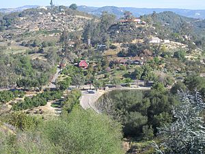
De Luz Heights is a small, quiet community located in the northwestern part of San Diego County, California. The name De Luz comes from Spanish and means "Of Light." It is an unincorporated community, which means it doesn't have its own city government. Instead, it is governed by the county.
Contents
Exploring De Luz Heights' Location
De Luz Heights is nestled on the Santa Rosa Plateau. This plateau is part of the larger Santa Ana Mountains range. You can find it between De Luz Road on the west side and Sandia Creek Drive on the east.
Where is De Luz Heights?
This community is located northwest of Fallbrook. It is also southwest of Temecula. Right next to it, on the east, is the large Marine Corps Base Camp Pendleton.
What is De Luz Heights Known For?
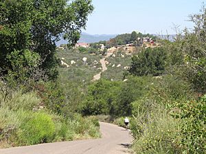
De Luz Heights is mainly an agricultural area. This means that farming is a big part of its economy. The community has many narrow country roads. These roads are often lined with different types of farms.
You will see many avocado groves here. There are also commercial flower nurseries, which grow flowers to sell. Citrus ranches, where fruits like oranges and lemons are grown, are common too. Lastly, you can find vineyards, which are farms that grow grapes, often for making wine.
See also
 In Spanish: De Luz Heights para niños
 | John T. Biggers |
 | Thomas Blackshear |
 | Mark Bradford |
 | Beverly Buchanan |


