Del Bonita, Alberta facts for kids
Quick facts for kids
Del Bonita
|
|
|---|---|
 |
|
| Country | Canada |
| Province | Alberta |
| Census division | No. 3 |
| Municipal district | Cardston County |
| Government | |
| • Type | Unincorporated |
| Elevation | 1,305 m (4,281 ft) |
| Population
(2008)
|
|
| • Total | 6 |
| Time zone | UTC−7 (MST) |
| • Summer (DST) | UTC−6 (MDT) |
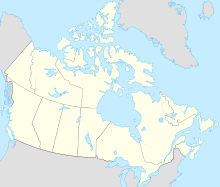
Del Bonita is a small community, called a hamlet, located in southern Alberta, Canada. It is part of Cardston County. The hamlet is about 49 kilometers (30 miles) south of Magrath. It sits where two highways meet: Highway 62 and Highway 501.
Because Del Bonita is very close to the Canada–United States border, it acts as a port of entry. This means it's a place where people can cross into the U.S. state of Montana. The border crossing is just 3 kilometers (1.9 miles) south of the hamlet. The name "Del Bonita" comes from Spanish and means "of the pretty".
The hamlet is located at an elevation of 1,305 meters (4,281 feet) above sea level. It is situated on Shanks Creek, which flows into Shanks Lake. This lake then connects to the Milk River further east.
There's also a special airport nearby called Del Bonita/Whetstone International Airport. It's unique because it's located right on the border between Canada and the United States!
Contents
People Living in Del Bonita
How Many People Live Here?
According to a count done by Cardston County in 2008, only 6 people lived in Del Bonita. This makes it a very small community!
Fun Things to See
Buildings from a Ghost Town
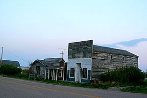
Some interesting old buildings and items from a nearby ghost town called Whiskey Gap have been moved to Del Bonita. A ghost town is a place that used to have many people but is now mostly empty. These moved buildings include the Whiskey Gap Oil Shed and the Huey Gum Restaurant, which also had a pool hall and rooms.
Famous People from Del Bonita
Earl W. Bascom: Cowboy and Inventor
Earl W. Bascom (1906-1995) was a famous cowboy and rodeo champion. He is sometimes called the "father of modern rodeo" because he invented many things used in rodeos today. He was also an actor in Hollywood, an artist, and a sculptor. In the mid-1920s, Earl Bascom worked in Del Bonita for the Orgill Ranch. He also helped move horses to British Columbia for a rancher named Lamonde "Nick" Carter.
 | Isaac Myers |
 | D. Hamilton Jackson |
 | A. Philip Randolph |


