Delaware Boundary Markers facts for kids
Quick facts for kids |
|
|
Delaware Boundary Markers
|
|

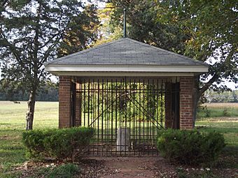
Mason–Dixon Monument, October 2011
|
|
| Lua error in Module:Location_map at line 420: attempt to index field 'wikibase' (a nil value). | |
| Location | State boundary lines between DE-MD/DE-PA, Delaware |
|---|---|
| Area | 0 acres (0 ha) |
| Built | 1763 |
| Architect | Mason, Charles; Dixon, Jeremiah |
| NRHP reference No. | 75002101 |
| Added to NRHP | February 18, 1975 |
The Delaware Boundary Markers are a collection of important historical markers. They show the exact border lines between the states of Delaware, Maryland, and Pennsylvania. This area is considered a historic district.
A historic district is a special area that has many important historical sites. This district includes 94 different spots along the famous Mason–Dixon line. It also features other key lines like the Transpeninsular Line, the "Post Marked West" site, the Tangent Line, The Arc, and The Twelve-Mile Circle. These markers help us understand how these states were formed.
The Delaware Boundary Markers were added to the National Register of Historic Places in 1975. This means they are recognized as very important to the history of the United States.
Contents
What Are Boundary Markers?
Boundary markers are physical objects like stones or posts. They are placed on the ground to show where one area ends and another begins. Think of them like invisible fences that become real. These markers are crucial for defining state borders. They help prevent arguments over land.
Why Were These Lines Needed?
In the early days of America, there were often big arguments over land. Different colonies, which later became states, claimed the same areas. To solve these problems, leaders decided to draw clear lines on maps. Then, they hired people to mark these lines on the ground. This helped everyone know exactly where their land ended. It also helped avoid conflicts between settlers and governments.
The Mason-Dixon Line
The most famous boundary line in this district is the Mason-Dixon Line. This line was created to settle a long-running dispute. It was between the Penn family of Pennsylvania and the Calvert family of Maryland. They both claimed the same land. This line became a very important symbol in American history. It often marked the division between northern and southern states.
The Twelve-Mile Circle
Another unique part of Delaware's border is the Twelve-Mile Circle. This is a perfect circle drawn around the city of New Castle, Delaware. It was part of the original land grant for William Penn. The circle forms a large part of Delaware's northern border with Pennsylvania. It is one of the few perfectly circular borders in the world.
Other Important Lines
Besides the Mason-Dixon Line and the Twelve-Mile Circle, other lines are also important. The Transpeninsular Line runs across the peninsula. The Tangent Line connects the Twelve-Mile Circle to the Mason-Dixon Line. The "Post Marked West" site marks a specific point on the border. All these lines together show the careful work done to define state boundaries.
Who Were Mason and Dixon?
The famous Mason-Dixon Line is named after two British surveyors. They were Charles Mason and Jeremiah Dixon. They were skilled astronomers and mathematicians. They were hired in the 1760s to survey and mark the disputed boundary. They worked for several years, using advanced tools for their time. Their careful work helped create one of the most accurate borders of that era.
Protecting These Historic Markers
The Delaware Boundary Markers are protected as a historic district. This means they are preserved for future generations. They remind us of the challenges faced by early American settlers. They also show the clever ways people solved big problems. Protecting these markers helps us learn about our history. It also teaches us about the importance of clear boundaries.

