
Dogwood, Douglas County, Missouri facts for kids
Quick facts for kids
Dogwood, Missouri
|
|
|---|---|
|
Community
|
|

The old flagstone store building at Dogwood, Missouri
|
|

Dogwood, Missouri
Location in Missouri
|
|
| Country | U. S. A. |
| State | Missouri |
| County | Douglas County |
| Elevation | 510 m (1,680 ft) |
| Time zone | UTC-6 (CST) |
| • Summer (DST) | UTC-5 (CDT) |
| GNIS feature ID | 716961 |
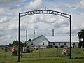
Dogwood is a small, unincorporated community in Douglas County, Missouri, in the United States. This means it's not a city or town with its own local government. It's a collection of homes and buildings. You can find Dogwood on Missouri Route 14. It is about 15.5 miles northwest of Ava. It is also about 8.5 miles southwest of Seymour. An old store building sits where Route 14 meets Route BB. The Dogwood cemetery is nearby, about 1300 feet west. It is located at the intersection of routes 14 and Z.
History of Dogwood
Dogwood has an interesting past. In 1879, a veteran from the American Civil War built a log store and home here. It was next to a spring surrounded by beautiful dogwood trees. This spot was along an old path called the Salt Road. People used this road to transport salt, wood, and other goods. They moved materials between northern Arkansas and Springfield.
A post office was opened in Dogwood in 1880. It served the community until 1909. A school was also started in 1888. A log school building was built north of the store in 1891. This log building was later replaced by a new frame building in 1910. The school was about 0.75 miles north of the store.
In 1900, a missionary started holding church services in the school building. By 1905, a church building was built, and land was set aside for a cemetery. In 1932, Route 14 was made wider and rerouted. Because of this, the church was moved to its current spot north of the cemetery. Another church was built north of the store in 1904. A third church was built to the southeast on Route 14 in 1931.
Geography of Dogwood
Dogwood is located on a ridge. It sits at an elevation of about 1680 feet. This area is on the edge of the Springfield Plateau. To the east are the steep valleys of the Beaver Creek. To the southwest are the valleys of the Swan Creek. The Dogwood fire tower is nearby. There is also a state hunting area on Tigris Peak. This area is about 1.7 miles to the southeast.
Images for kids
-
Dogwood cemetery just west of the old store

