Beaver Creek (White River tributary) facts for kids
Quick facts for kids Beaver Creek |
|
|---|---|

|
|
| Country | United States |
| State | Missouri |
| Region | Douglas, Webster and Taney counties |
| Physical characteristics | |
| Main source | 37°04′18″N 92°43′12″W / 37.07167°N 92.72000°W |
| River mouth | 643 ft (196 m) 36°38′18″N 93°02′25″W / 36.63833°N 93.04028°W |
| Basin features | |
| Tributaries |
|
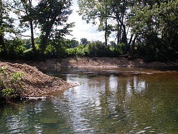
Beaver Creek is a cool stream in Missouri, flowing through Douglas and Taney counties. It's like a smaller river that eventually joins the big White River in northern Arkansas.
Contents
Discovering Beaver Creek
Why Is It Called Beaver Creek?
This creek got its name because, a long time ago, there were lots of beaver dams built by beavers! These amazing animals are known for building dams across streams.
Where Does Beaver Creek Start and End?
Beaver Creek begins its journey in the northern part of Douglas County and a tiny bit of southeastern Webster County. This is near the towns of Ava and Seymour.
From there, it flows south and southwest. Its adventure ends when it meets the White River. This meeting point is southeast of Forsyth and south of Kissee Mills, right below the dam for Lake Taneycomo.
What Is a Drainage Basin?
Every stream and river has a "drainage basin." Think of it like a giant funnel. All the rain and water that falls within this area will eventually flow into that stream. For Beaver Creek, its drainage basin is huge, covering about 267,344 acres (108,190 ha)! That's a lot of land feeding water into the creek.
Exploring Its Path
Beaver Creek winds its way through many interesting places.
- Near Tigris, you can see Missouri Route 14 crossing over the creek.
- Soon after, another stream called Honey Creek joins Beaver Creek.
- As it flows past Arno, more creeks like Cowskin and Prairie Creek add their water.
- Further south, at Rome, Spring Creek joins the fun.
- Southwest of Rome, Beaver Creek enters Taney County near Brownbranch.
Through Forests and Wilderness
After Brownbranch, the creek flows west into the beautiful Mark Twain National Forest. Here, it's joined by Little Beaver Creek just north of Bradleyville.
Beyond Bradleyville, Beaver Creek flows through what are called "incised meanders." This means the creek has carved deep, winding curves into the land over many years. It passes by the amazing Hercules Glades Wilderness area, a special place for nature.
Finally, at Kissee Mills Park, Beaver Creek goes under US 160. A short distance south, it flows into Bull Shoals Lake at Beaver Creek Park, completing its long journey.
 | Ernest Everett Just |
 | Mary Jackson |
 | Emmett Chappelle |
 | Marie Maynard Daly |

