Dola, Ohio facts for kids
Quick facts for kids
Dola, Ohio
|
|
|---|---|

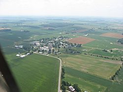
Aerial view of Dola
|
|
| Country | United States |
| State | Ohio |
| County | Hardin |
| Township | Washington |
| Area | |
| • Total | 0.83 sq mi (2.15 km2) |
| • Land | 0.83 sq mi (2.15 km2) |
| • Water | 0.00 sq mi (0.00 km2) |
| Elevation | 938 ft (286 m) |
| Population
(2020)
|
|
| • Total | 143 |
| • Density | 171.88/sq mi (66.40/km2) |
| Time zone | UTC-5 (Eastern (EST)) |
| • Summer (DST) | UTC-4 (EDT) |
| ZIP Code |
45835
|
| Area code(s) | 419 |
| FIPS code | 39-22260 |
| GNIS feature ID | 2628884 |
Dola is a small community located in Ohio, United States. It is known as a census-designated place, or CDP. This means it is an area identified by the government for counting its population. In 2020, about 143 people lived in Dola. It has its own post office and a special code called a ZIP code, which is 45835. Dola is found in Hardin County, within Washington Township.
Contents
History
The settlement was established in 1852 and was originally known as "North Washington". The name was changed to "Dola" in 1906 in order to avoid confusion with North Washington in Hardin County, Ohio as both places were shortened to N. Washington in postal service. The name Dola was suggested by Mrs. Anna Clevenger, the wife of Dola's medical doctor, R.E. Clevenger, a general practitioner who served from 1884 to 1925. Green marshlands of North Washington reminded Mrs. Clevenger of her birthplace, Dolau farm in Llanerfyl, Montgomeryshire, Wales. The word Dolau means "meadows" in Welsh. The people of North Washington liked the name and the settlement was renamed in 1906.
Geography and Location of Dola
Where is Dola Located?
Dola is situated in central Washington Township. It lies along Ohio State Route 81, a main road that connects it to other towns. These towns include Ada and Dunkirk.
Distance from the County Seat
Dola is about 12 miles (19 kilometers) by road from Kenton. Kenton is an important city because it is the county seat of Hardin County. This means it is the center for the county's government.
Local Waterways
Dola is also located near the beginning of the Eagle Creek. This creek flows north from Dola. It eventually joins the Blanchard River in the city of Findlay.
Land Area of Dola
According to the U.S. Census Bureau, the Dola CDP covers an area of about 0.83 square miles (2.15 square kilometers). All of this area is land, with no water.
Population of Dola
How Many People Live in Dola?
| Historical population | |||
|---|---|---|---|
| Census | Pop. | %± | |
| 2020 | 143 | — | |
| U.S. Decennial Census | |||
The population of Dola was counted during the 2020 United States Census. At that time, 143 people were living in the community. The census helps us understand how many people live in different places.
Education in the Dola Area
Hardin Northern High School
Hardin Northern High School is located about 2 miles (3 kilometers) east of the center of Dola. Even though it's not right in Dola, the school is often linked to the community.
School's Connection to Dola
Many people and sports news outlets, like JJ Huddle, often refer to the school as "Dola Hardin Northern." This shows the strong connection between the school and the Dola community.
See also
 In Spanish: Dola (Ohio) para niños
 | Stephanie Wilson |
 | Charles Bolden |
 | Ronald McNair |
 | Frederick D. Gregory |


