Douville River facts for kids
Quick facts for kids Douville |
|
|---|---|

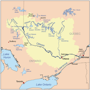
Map of Ottawa River watershed
|
|
| Country | Canada |
| Province | Quebec |
| Region | Mauricie |
| Physical characteristics | |
| Main source | Claire Lake La Tuque (Fortier Township), Mauricie, Quebec 444 m (1,457 ft) 47°58′34″N 75°15′27″W / 47.97611°N 75.25750°W |
| River mouth | Bureau Lake (South Bay) La Tuque (Gosselin Township), Mauricie, Quebec 401 m (1,316 ft) 47°53′25″N 75°30′12″W / 47.89028°N 75.50333°W |
| Length | 29.6 km (18.4 mi) |
The Douville River is a cool waterway located entirely in Quebec, Canada. It's a branch, or "tributary," of the Gatineau River. This river flows north of the mighty Saint Lawrence River. You can find it in the Mauricie region, specifically within the large area of La Tuque.
This river winds through a beautiful forest. It follows a small valley, making its way through untouched nature. There are no towns or resorts along its path. During the colder months, from about mid-December to the end of March, the river's surface usually freezes over.
Contents
The Douville River's Journey
Where the River Starts
The Douville River begins its adventure at a place called Claire Lake. This lake is about 1.1 kilometres (0.68 mi) long. It sits high up at an altitude of 444 metres (1,457 ft) (that's about 1,457 feet!). This starting point is in the Fortier Township, which is part of La Tuque.
Following the Flow
From Claire Lake, the Douville River travels for about 29.6 kilometres (18.4 mi) (or 18.4 miles). Here's how its journey unfolds:
- First, it flows about 0.7 kilometres (0.43 mi) (0.4 miles) north. It reaches the southern edge of a lake that doesn't have a name.
- Next, it turns southwest for 6.5 kilometres (4.0 mi) (4.0 miles). Along this part, it crosses through Fortin Lake. Fortin Lake is 2.8 kilometres (1.7 mi) (1.7 miles) long and sits at 442 metres (1,450 ft) (1,450 feet) high.
- Then, the river goes south for 5.8 kilometres (3.6 mi) (3.6 miles). It makes a big curve to the west. This leads it to the northeast shore of Douville Lake.
- It continues southwest across Douville Lake for 1.7 kilometres (1.1 mi) (1.1 miles). Douville Lake is at an altitude of 430 metres (1,410 ft) (1,411 feet).
- After that, it flows southwest for 3.8 kilometres (2.4 mi) (2.4 miles). It crosses Young Lake from one end to the other. Young Lake is also at 430 metres (1,410 ft) (1,411 feet) high.
- Finally, the river travels west for 5.6 kilometres (3.5 mi) (3.5 miles). This brings it to where it joins another body of water.
Where the River Ends
The Douville River eventually flows into the eastern shore of Pain de Sucre (La Tuque). This lake is actually the starting point for the Gatineau River. The Gatineau River then flows into the larger Ottawa River.
The spot where the Douville River joins Pain de Sucre Lake is located:
- About 2.0 kilometres (1.2 mi) (1.2 miles) downstream from where the Tamarac River joins the Pain de Sucre Lake.
- About 3.2 kilometres (2.0 mi) (2.0 miles) upstream from the very end of Sugar Loaf Lake (La Tuque).
- About 68.8 kilometres (42.8 mi) (42.8 miles) west of the village of Parent.
- About 154 kilometres (96 mi) (96 miles) north of downtown Mont-Laurier.
What's in a Name?
The name "Douville" comes from a family name. It is a French last name. The name "rivière Douville" was officially recognized on December 5, 1968. This was done by the Commission de toponymie du Québec, which is like the official naming board for places in Quebec.
 | James Van Der Zee |
 | Alma Thomas |
 | Ellis Wilson |
 | Margaret Taylor-Burroughs |

