Dowlingville, South Australia facts for kids
Quick facts for kids DowlingvilleSouth Australia |
|||||||||||||||
|---|---|---|---|---|---|---|---|---|---|---|---|---|---|---|---|

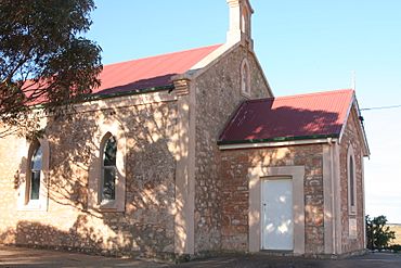
Dowlingville Uniting (formerly Methodist) Church in 2012
|
|||||||||||||||
| Established | 1999 | ||||||||||||||
| Postcode(s) | 5555 | ||||||||||||||
| Time zone | ACST (UTC+9:30) | ||||||||||||||
| • Summer (DST) | ACST (UTC+10:30) | ||||||||||||||
| Location | 89 km (55 mi) north-west of Adelaide | ||||||||||||||
| LGA(s) | Yorke Peninsula Council | ||||||||||||||
| Region | Yorke and Mid North | ||||||||||||||
| County | Fergusson | ||||||||||||||
| State electorate(s) | Narungga | ||||||||||||||
| Federal Division(s) | Grey | ||||||||||||||
|
|||||||||||||||
|
|||||||||||||||
| Footnotes | Distances Coordinates Climate Adjoining localities |
||||||||||||||
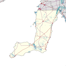
Dowlingville is a small place, or "locality," found in South Australia, Australia. It sits right on the eastern coast of the Yorke Peninsula, next to a large body of water called Gulf St Vincent. Dowlingville is about 89 kilometers (55 miles) north-west of Adelaide, which is the capital city of South Australia. The official boundaries for Dowlingville were set up in May 1999.
About Dowlingville
The name Dowlingville likely came from an early resident named Mr. G.P. Dowling Whittaker. In 1904, people described the area as mostly farmland. Back then, it only had a few houses, one store, a post office, a school, and a church. Before that, the land was covered in scrub. Farmers worked hard to clear the land and make it suitable for growing crops.
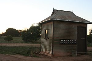
The old Dowlingville Post Office is a special building in the area. It is listed on the South Australian Heritage Register, which means it's an important historical site.
What People Do Here
As of 2014, most of the land in Dowlingville is used for "primary production." This means people are mainly involved in activities like farming, which produce raw materials.
Government and Representation
Dowlingville is part of different government areas.
- For national elections, it's in the federal Division of Grey.
- For state elections in South Australia, it's in the Electoral district of Narungga.
- For local services and decisions, it's looked after by the Yorke Peninsula Council.
 | William Lucy |
 | Charles Hayes |
 | Cleveland Robinson |


