Drawyer Creek (Appoquinimink River tributary) facts for kids
Quick facts for kids Drawyer Creek |
|
|---|---|

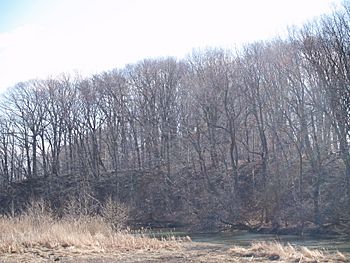
Bluff above Drawyer Creek in 2008
|
|
|
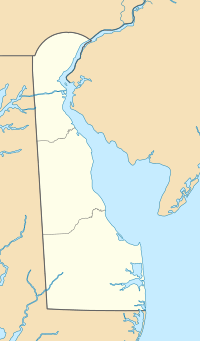
Location of mouth in Delaware##Location of mouth in United States
|
|
| Other name(s) | Tributary to Delaware Bay |
| Country | United States |
| State | Delaware |
| County | New Castle |
| Physical characteristics | |
| Main source | divide between Drawyer Creek and Back Creek Meadowbrook Farms, Delaware 70 ft (21 m) 39°30′13″N 075°42′19″W / 39.50361°N 75.70528°W |
| River mouth | Delaware Bay about 1 northeast of Odessa, Delaware 0 ft (0 m) 39°27′57″N 075°42′19″W / 39.46583°N 75.70528°W |
| Length | 6.26 mi (10.07 km) |
| Basin features | |
| Progression | generally southeast |
| River system | Delaware Bay |
| Basin size | 15.56 square miles (40.3 km2) |
| Tributaries |
|
Drawyer Creek is a waterway in New Castle County, Delaware. It flows for about 6.26 miles (10.07 kilometers) before joining the larger Delaware Bay. Most of Drawyer Creek is affected by tides, meaning its water levels change with the ocean's tides.
Contents
About Drawyer Creek
Drawyer Creek is a stream that flows into the Delaware Bay. It is considered a 'tributary,' which means it is a smaller stream that feeds into a larger body of water. Most of the creek is 'tidal,' meaning its water levels go up and down with the ocean's tides. However, the part of the creek above Shallcross Lake is not tidal.
Where is Drawyer Creek Located?
This creek is found in New Castle County, Delaware. Its journey begins near Meadowbrook Farms. From there, it generally flows towards the southeast. The creek eventually empties into the Delaware Bay, which is a large estuary on the Atlantic coast. The mouth of the creek is located about 1 mile (1.6 kilometers) northeast of Odessa, Delaware.
How Long is Drawyer Creek?
Drawyer Creek is about 6.26 miles (10.07 kilometers) long. It starts at an elevation of about 70 feet (21 meters) above sea level. By the time it reaches the Delaware Bay, its elevation is 0 feet, meaning it is at sea level. The area of land that drains into Drawyer Creek, called its 'basin,' is about 15.56 square miles (40.3 square kilometers).
What is Near Drawyer Creek?
An important historical building, Old Drawyers Church, is located to the south of Drawyer Creek. This church has a long history in the area. The creek also connects to the Appoquinimink River, which is another significant waterway in Delaware.
 | Misty Copeland |
 | Raven Wilkinson |
 | Debra Austin |
 | Aesha Ash |


